Ogndal
Ogndal herad
Skei herred | |
|---|---|
 Nord-Trøndelag within Norway | |
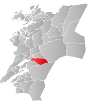 Ogndal within Nord-Trøndelag | |
| Coordinates: 64°01′11″N 11°37′52″E / 64.01972°N 11.63111°ECoordinates: 64°01′11″N 11°37′52″E / 64.01972°N 11.63111°E | |
| Country | Norway |
| County | Nord-Trøndelag |
| District | Innherred |
| Established | 1 Jan 1885 |
| Disestablished | 1 Jan 1964 |
| Administrative centre | Steinkjer |
| Area | |
| • Total | 418 km2 (161 sq mi) |
| *Area at municipal dissolution. | |
| Population (1964) | |
| • Total | 2,678 |
| • Density | 6.4/km2 (17/sq mi) |
| Demonym(s) | ogndaling[1] |
| Time zone | UTC+01:00 (CET) |
| • Summer (DST) | UTC+02:00 (CEST) |
| ISO 3166 code | NO-1732 |
| Preceded by | Sparbu in 1885 |
| Succeeded by | Steinkjer in 1964 |

Ogndal is a former municipality in what was the old Nord-Trøndelag county, Norway. The 418-square-kilometre (161 sq mi) municipality existed from 1885 until its dissolution in 1964. The municipality included the whole Ogndalen valley and areas to the west, up to, but not including the town of Steinkjer in what is now the central and western part of the municipality of Steinkjer in Trøndelag county. Starting in 1917, the administrative center of Ogndal was actually located in the town of Steinkjer (even though that was not a part of Ogndal municipality).[2][3]


The main church for Ogndal, Skei Church, is located in the village of Skei in western Ogndal. Another church, Bodom Church, is located in the village of in the eastern part of the municipality.
History[]
The municipality of Skei was established on 1 January 1885 when it was separated from the larger municipality of Sparbu. The initial population of Skei was 1,441. On 13 December 1900, the name was changed from Skei to Ogndal, since the municipality encompasses the Ogndalen valley, through which the river flows.
The municipality of Ogndal bordered the growing town of Steinkjer and as Steinkjer grew, it took over parts of Ogndal. On 1 January 1902, an unpopulated area in western Ogndal was transferred to the town of Steinkjer. In 1941, another small area of Ogndal (population: 57) was transferred to the town of Steinkjer. Again, in 1948, another small area of Ogndal (population: 78) was transferred to Steinkjer.
During the 1960s, there were many municipal mergers across Norway due to the work of the Schei Committee. On 1 January 1964, a large merger took place: the neighboring municipalities of Beitstad (population: 2,563), Egge (population: 3,476), Kvam (population: 1,245), Ogndal (population: 2,678), Sparbu (population: 4,027), and Stod (population: 1,268) were all merged with the town of Steinkjer (population: 4,325) to form the new municipality of Steinkjer.[4]
Government[]
All municipalities in Norway, including Ogndal, are responsible for primary education (through 10th grade), outpatient health services, senior citizen services, unemployment and other social services, zoning, economic development, and municipal roads. The municipality is governed by a municipal council of elected representatives, which in turn elects a mayor.[5]
Municipal council[]
The municipal council (Herredsstyre) of Ogndal was made up of representatives that were elected to four year terms. The party breakdown of the final municipal council was as follows:
| Party Name (in Norwegian) | Number of representatives | |
|---|---|---|
| Labour Party (Arbeiderpartiet) | 10 | |
| Centre Party (Senterpartiet) | 5 | |
| Liberal Party (Venstre) | 2 | |
| Total number of members: | 17 | |
See also[]
References[]
- ^ "Navn på steder og personer: Innbyggjarnamn" (in Norwegian). Språkrådet.
- ^ Steinkjerleksikonet. "Ogndal kommune" (in Norwegian). Retrieved 2011-07-16.
- ^ Thorsnæs, Geir, ed. (2018-02-05). "Ogndal". Store norske leksikon (in Norwegian). Kunnskapsforlaget. Retrieved 2018-04-07.
- ^ Jukvam, Dag (1999). "Historisk oversikt over endringer i kommune- og fylkesinndelingen" (PDF) (in Norwegian). Statistisk sentralbyrå.
- ^ Hansen, Tore, ed. (2016-05-12). "kommunestyre". Store norske leksikon (in Norwegian). Kunnskapsforlaget. Retrieved 2020-02-02.
- ^ "Kommunevalgene og Ordførervalgene 1959" (PDF) (in Norwegian). Oslo: Statistisk sentralbyrå. 1960. Retrieved 2020-04-14.
- ^ "Kommunevalgene og Ordførervalgene 1955" (PDF) (in Norwegian). Oslo: Statistisk sentralbyrå. 1957. Retrieved 2020-04-14.
- ^ "Kommunevalgene og Ordførervalgene 1951" (PDF) (in Norwegian). Oslo: Statistisk sentralbyrå. 1952. Retrieved 2020-04-14.
- ^ "Kommunevalgene og Ordførervalgene 1947" (PDF) (in Norwegian). Oslo: Statistisk sentralbyrå. 1948. Retrieved 2020-04-14.
- ^ "Kommunevalgene og Ordførervalgene 1945" (PDF) (in Norwegian). Oslo: Statistisk sentralbyrå. 1947. Retrieved 2020-04-14.
- ^ "Kommunevalgene og Ordførervalgene 1937" (PDF) (in Norwegian). Oslo: Statistisk sentralbyrå. 1938. Retrieved 2020-04-14.
| hide | |||
|---|---|---|---|
| |||
 | Towns and cities |  | |
| Municipalities | |||
| Authority control |
|
|---|
- Steinkjer
- Former municipalities of Norway
- 1885 establishments in Norway
- 1964 disestablishments in Norway