Labergement-lès-Seurre
From Wikipedia, the free encyclopedia
Commune in Bourgogne-Franche-Comté, France
Labergement-lès-Seurre | |
|---|---|
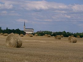 The church and surroundings in Labergement-lès-Seurre | |
 Labergement-lès-Seurre  Labergement-lès-Seurre | |
Coordinates:  46°59′56″N 5°05′36″E / 46.9989°N 5.0933°E / 46.9989; 5.0933Coordinates: 46°59′56″N 5°05′36″E / 46.9989°N 5.0933°E / 46.9989; 5.0933 46°59′56″N 5°05′36″E / 46.9989°N 5.0933°E / 46.9989; 5.0933Coordinates: 46°59′56″N 5°05′36″E / 46.9989°N 5.0933°E / 46.9989; 5.0933 | |
| Country | France |
| Region | Bourgogne-Franche-Comté |
| Department | Côte-d'Or |
| Arrondissement | Beaune |
| Canton | Brazey-en-Plaine |
| Intercommunality | Rives de Saône |
| Government | |
| • Mayor (2020–2026) | Joëlle Dufour |
| Area 1 | 28.83 km2 (11.13 sq mi) |
| Population (Jan. 2018)[1] | 998 |
| • Density | 35/km2 (90/sq mi) |
| Time zone | UTC+01:00 (CET) |
| • Summer (DST) | UTC+02:00 (CEST) |
| INSEE/Postal code | 21332 /21820 |
| Elevation | 174–211 m (571–692 ft) (avg. 208 m or 682 ft) |
| 1 French Land Register data, which excludes lakes, ponds, glaciers > 1 km2 (0.386 sq mi or 247 acres) and river estuaries. | |

show This article may be expanded with text translated from the corresponding article in French. (January 2009) Click [show] for important translation instructions.
|
Labergement-lès-Seurre (French pronunciation: [labɛʁʒəmɑ̃ lɛ sœʁ], literally Labergement near Seurre) is a commune in the Côte-d'Or department in eastern France.
Population[]
| Year | Pop. | ±% |
|---|---|---|
| 1962 | 644 | — |
| 1968 | 718 | +11.5% |
| 1975 | 663 | −7.7% |
| 1982 | 723 | +9.0% |
| 1990 | 785 | +8.6% |
| 1999 | 795 | +1.3% |
| 2008 | 942 | +18.5% |
See also[]
References[]
- ^ "Populations légales 2018". INSEE. 28 December 2020.
| Wikimedia Commons has media related to Labergement-lès-Seurre. |
| show | |
|---|---|
|
Retrieved from ""
Categories:
- Communes of Côte-d'Or
- Côte-d'Or geography stubs
Hidden categories:
- Articles with short description
- Short description is different from Wikidata
- Infobox mapframe without OSM relation ID on Wikidata
- Coordinates on Wikidata
- Pages using infobox settlement with image map1 but not image map
- Articles to be expanded from January 2009
- All articles to be expanded
- Geography articles needing translation from French Wikipedia
- Commons category link from Wikidata
- Articles with BNF identifiers
- All stub articles
- Pages using the Kartographer extension