Salives
From Wikipedia, the free encyclopedia
Commune in Bourgogne-Franche-Comté, France
Salives | |
|---|---|
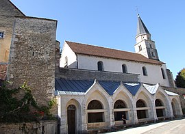 The church and washhouse in Salives | |
 Salives  Salives | |
Coordinates:  47°37′03″N 4°55′11″E / 47.6175°N 4.9197°E / 47.6175; 4.9197Coordinates: 47°37′03″N 4°55′11″E / 47.6175°N 4.9197°E / 47.6175; 4.9197 47°37′03″N 4°55′11″E / 47.6175°N 4.9197°E / 47.6175; 4.9197Coordinates: 47°37′03″N 4°55′11″E / 47.6175°N 4.9197°E / 47.6175; 4.9197 | |
| Country | France |
| Region | Bourgogne-Franche-Comté |
| Department | Côte-d'Or |
| Arrondissement | Dijon |
| Canton | Is-sur-Tille |
| Government | |
| • Mayor (2020–2026) | Charles Schneider |
| Area 1 | 47.85 km2 (18.47 sq mi) |
| Population (Jan. 2018)[1] | 200 |
| • Density | 4.2/km2 (11/sq mi) |
| Time zone | UTC+01:00 (CET) |
| • Summer (DST) | UTC+02:00 (CEST) |
| INSEE/Postal code | 21579 /21580 |
| Elevation | 343–527 m (1,125–1,729 ft) (avg. 400 m or 1,300 ft) |
| 1 French Land Register data, which excludes lakes, ponds, glaciers > 1 km2 (0.386 sq mi or 247 acres) and river estuaries. | |

Salives (French pronunciation: [saliv]) is a commune in the Côte-d'Or department in eastern France.
Population[]
| Year | Pop. | ±% |
|---|---|---|
| 1962 | 329 | — |
| 1968 | 346 | +5.2% |
| 1975 | 286 | −17.3% |
| 1982 | 229 | −19.9% |
| 1990 | 180 | −21.4% |
| 1999 | 232 | +28.9% |
| 2008 | 267 | +15.1% |
See also[]
References[]
- ^ "Populations légales 2018". INSEE. 28 December 2020.
| Wikimedia Commons has media related to Salives. |
| show | |
|---|---|
|
Retrieved from ""
Categories:
- Communes of Côte-d'Or
- Côte-d'Or geography stubs
Hidden categories:
- Articles with short description
- Short description is different from Wikidata
- Infobox mapframe without OSM relation ID on Wikidata
- Coordinates on Wikidata
- Pages using infobox settlement with image map1 but not image map
- Commons category link from Wikidata
- Articles with BNF identifiers
- All stub articles
- Pages using the Kartographer extension