Reulle-Vergy
Reulle-Vergy | |
|---|---|
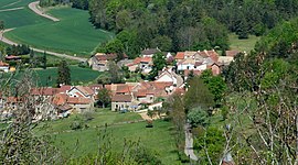 A general view of Reulle-Vergy | |
show Location of Reulle-Vergy | |
 Reulle-Vergy | |
| Coordinates: 47°11′14″N 4°53′44″E / 47.1872°N 4.8956°ECoordinates: 47°11′14″N 4°53′44″E / 47.1872°N 4.8956°E | |
| Country | France |
| Region | Bourgogne-Franche-Comté |
| Department | Côte-d'Or |
| Arrondissement | Beaune |
| Canton | Longvic |
| Intercommunality | |
| Government | |
| • Mayor (2014-2020) | Aleth Detot |
| Area 1 | 6.13 km2 (2.37 sq mi) |
| Population (Jan. 2018)[1] | 142 |
| • Density | 23/km2 (60/sq mi) |
| Time zone | UTC+01:00 (CET) |
| • Summer (DST) | UTC+02:00 (CEST) |
| INSEE/Postal code | 21523 /21220 |
| Elevation | 320–526 m (1,050–1,726 ft) |
| 1 French Land Register data, which excludes lakes, ponds, glaciers > 1 km2 (0.386 sq mi or 247 acres) and river estuaries. | |


Reulle-Vergy is a commune in the Côte-d'Or department in eastern France.
Population[]
| Year | Pop. | ±% |
|---|---|---|
| 2005 | 100 | — |
| 2006 | 93 | −7.0% |
| 2007 | 91 | −2.2% |
| 2008 | 100 | +9.9% |
| 2009 | 110 | +10.0% |
| 2010 | 120 | +9.1% |
| 2011 | 123 | +2.5% |
| 2012 | 131 | +6.5% |
| 2013 | 132 | +0.8% |
| 2014 | 134 | +1.5% |
| 2015 | 135 | +0.7% |
| 2016 | 134 | −0.7% |
Politics[]
Presidential Elections 2nd Round [2][]
| Election | Winning Candidate | Party | % | |
|---|---|---|---|---|
| 2017 | Emmanuel Macron | EM | 66.23 | |
| 2012 | François Hollande | PS | 56.63 | |
| 2007 | Nicolas Sarkozy | UMP | 52.86 | |
| 2002 | Jacques Chirac | RPR | 85.00 | |
See also[]
References[]
- ^ "Populations légales 2018". INSEE. 28 December 2020.
- ^ http://www.lemonde.fr/data/france/presidentielle-2017/
| Wikimedia Commons has media related to Reulle-Vergy. |
| Authority control |
|---|
This Côte-d'Or geographical article is a stub. You can help Wikipedia by . |
Categories:
- Communes of Côte-d'Or
- Côte-d'Or geography stubs