Laperrière-sur-Saône
From Wikipedia, the free encyclopedia
Commune in Bourgogne-Franche-Comté, France
Laperrière-sur-Saône | |
|---|---|
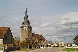 The church in Laperrière-sur-Saône | |
 Coat of arms | |
 Laperrière-sur-Saône  Laperrière-sur-Saône | |
Coordinates:  47°06′45″N 5°20′32″E / 47.1125°N 5.3422°E / 47.1125; 5.3422Coordinates: 47°06′45″N 5°20′32″E / 47.1125°N 5.3422°E / 47.1125; 5.3422 47°06′45″N 5°20′32″E / 47.1125°N 5.3422°E / 47.1125; 5.3422Coordinates: 47°06′45″N 5°20′32″E / 47.1125°N 5.3422°E / 47.1125; 5.3422 | |
| Country | France |
| Region | Bourgogne-Franche-Comté |
| Department | Côte-d'Or |
| Arrondissement | Beaune |
| Canton | Brazey-en-Plaine |
| Intercommunality | Rives de Saône |
| Government | |
| • Mayor (2020–2026) | Jean-Luc Soller[1] |
| Area 1 | 11.17 km2 (4.31 sq mi) |
| Population (Jan. 2018)[2] | 442 |
| • Density | 40/km2 (100/sq mi) |
| Time zone | UTC+01:00 (CET) |
| • Summer (DST) | UTC+02:00 (CEST) |
| INSEE/Postal code | 21342 /21170 |
| Elevation | 180–201 m (591–659 ft) (avg. 210 m or 690 ft) |
| 1 French Land Register data, which excludes lakes, ponds, glaciers > 1 km2 (0.386 sq mi or 247 acres) and river estuaries. | |

show This article may be expanded with text translated from the corresponding article in French. (January 2009) Click [show] for important translation instructions.
|
Laperrière-sur-Saône (French pronunciation: [lapɛʁjɛʁ syʁ son], literally Laperrière on Saône) is a commune in the Côte-d'Or department in eastern France.
Population[]
| Year | Pop. | ±% |
|---|---|---|
| 1962 | 231 | — |
| 1968 | 267 | +15.6% |
| 1975 | 239 | −10.5% |
| 1982 | 273 | +14.2% |
| 1990 | 325 | +19.0% |
| 1999 | 301 | −7.4% |
| 2008 | 412 | +36.9% |
See also[]
References[]
- ^ "Répertoire national des élus: les maires". data.gouv.fr, Plateforme ouverte des données publiques françaises (in French). 2 December 2020.
- ^ "Populations légales 2018". INSEE. 28 December 2020.
| Wikimedia Commons has media related to Laperrière-sur-Saône. |
| show | |
|---|---|
|
| show Authority control | |
|---|---|
| General |
|
| National libraries | |
Retrieved from ""
Categories:
- Communes of Côte-d'Or
- Côte-d'Or geography stubs
Hidden categories:
- CS1 French-language sources (fr)
- Articles with short description
- Short description is different from Wikidata
- Infobox mapframe without OSM relation ID on Wikidata
- Coordinates on Wikidata
- Pages using infobox settlement with image map1 but not image map
- Articles to be expanded from January 2009
- All articles to be expanded
- Geography articles needing translation from French Wikipedia
- Commons category link from Wikidata
- Articles with VIAF identifiers
- Articles with BNF identifiers
- Articles with WorldCat-VIAF identifiers
- All stub articles
- Pages using the Kartographer extension