Marcellois
From Wikipedia, the free encyclopedia
Commune in Bourgogne-Franche-Comté, France
Marcellois | |
|---|---|
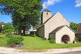 The church in Marcellois | |
 Marcellois  Marcellois | |
Coordinates:  47°20′59″N 4°36′50″E / 47.3497°N 4.6139°E / 47.3497; 4.6139Coordinates: 47°20′59″N 4°36′50″E / 47.3497°N 4.6139°E / 47.3497; 4.6139 47°20′59″N 4°36′50″E / 47.3497°N 4.6139°E / 47.3497; 4.6139Coordinates: 47°20′59″N 4°36′50″E / 47.3497°N 4.6139°E / 47.3497; 4.6139 | |
| Country | France |
| Region | Bourgogne-Franche-Comté |
| Department | Côte-d'Or |
| Arrondissement | Montbard |
| Canton | Semur-en-Auxois |
| Government | |
| • Mayor (2008–2014) | Rémy Ortiz |
| Area 1 | 3.66 km2 (1.41 sq mi) |
| Population (Jan. 2018)[1] | 48 |
| • Density | 13/km2 (34/sq mi) |
| Time zone | UTC+01:00 (CET) |
| • Summer (DST) | UTC+02:00 (CEST) |
| INSEE/Postal code | 21377 /21350 |
| Elevation | 380–552 m (1,247–1,811 ft) (avg. 507 m or 1,663 ft) |
| 1 French Land Register data, which excludes lakes, ponds, glaciers > 1 km2 (0.386 sq mi or 247 acres) and river estuaries. | |

Marcellois is a commune in the Côte-d'Or department in eastern France.
Population[]
| Year | Pop. | ±% |
|---|---|---|
| 1962 | 28 | — |
| 1968 | 35 | +25.0% |
| 1975 | 29 | −17.1% |
| 1982 | 24 | −17.2% |
| 1990 | 23 | −4.2% |
| 1999 | 24 | +4.3% |
| 2008 | 33 | +37.5% |
See also[]
References[]
- ^ "Populations légales 2018". INSEE. 28 December 2020.
| Wikimedia Commons has media related to Marcellois. |
| show | |
|---|---|
|
Retrieved from ""
Categories:
- Communes of Côte-d'Or
- Côte-d'Or geography stubs
Hidden categories:
- Articles with short description
- Short description is different from Wikidata
- Infobox mapframe without OSM relation ID on Wikidata
- Coordinates on Wikidata
- Pages using infobox settlement with image map1 but not image map
- Commons category link from Wikidata
- Articles with BNF identifiers
- All stub articles
- Pages using the Kartographer extension