Lantenot
Lantenot | |
|---|---|
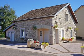 The town hall in Lantenot | |
 Coat of arms | |
show Location of Lantenot | |
 Lantenot | |
| Coordinates: 47°45′01″N 6°29′47″E / 47.7503°N 6.4964°ECoordinates: 47°45′01″N 6°29′47″E / 47.7503°N 6.4964°E | |
| Country | France |
| Region | Bourgogne-Franche-Comté |
| Department | Haute-Saône |
| Arrondissement | Lure |
| Canton | Mélisey |
| Government | |
| • Mayor (2020–2026) | David Balaud |
| Area 1 | 8.26 km2 (3.19 sq mi) |
| Population (Jan. 2018)[1] | 355 |
| • Density | 43/km2 (110/sq mi) |
| Time zone | UTC+01:00 (CET) |
| • Summer (DST) | UTC+02:00 (CEST) |
| INSEE/Postal code | 70294 /70200 |
| Elevation | 207–431 m (679–1,414 ft) |
| 1 French Land Register data, which excludes lakes, ponds, glaciers > 1 km2 (0.386 sq mi or 247 acres) and river estuaries. | |


Lantenot (French pronunciation: [lɑ̃tno]) is a commune in the Haute-Saône department in the region of Bourgogne-Franche-Comté in eastern France.
See also[]
References[]
- ^ "Populations légales 2018". INSEE. 28 December 2020.
| Wikimedia Commons has media related to Lantenot. |
This Haute-Saône geographical article is a stub. You can help Wikipedia by . |
Categories:
- Communes of Haute-Saône
- Haute-Saône geography stubs