List of snowiest places in the United States by state
The List of snowiest places in the United States by state shows average annual snowfall totals for the period mid-1985 to mid-2015. Only places in the official climate database of the National Weather Service, a service of NOAA, are included in this list. Some ski resorts and unofficial weather stations report higher amounts of snowfall than places on this list. Official weather stations are usually located in populated places and snowfall statistics for isolated and unpopulated areas are often not recorded.
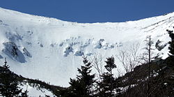
Mount Rainier and Mount Baker in Washington are the snowiest places in the United States which have weather stations, receiving 645 inches (1,640 cm) annually on average. By comparison, the populated place with the highest snowfall in the world is believed to be Sukayu Onsen in the Siberian-facing Japanese Alps. Sukayu Onsen receives 694.5 inches (1,764 cm) (nearly 58 feet) of snow annually. Nearby mountain slopes may receive even more.[1]
The amount of snow received at weather stations varies substantially from year to year. For example, the annual snowfall at Paradise Ranger Station in Mount Rainier National Park has been as little as 266 inches (680 cm) in 2014-2015 and as much as 1,122 inches (2,850 cm) in 1971-1972.[2]


| State | Place | Average annual snowfall[3] | elevation of weather station [4] | coordinates[5] | Other snowy areas (limited or unofficial data) and notes |
|---|---|---|---|---|---|
| 1. Washington | Paradise, Mount Rainier | 645.5 inches (1,640 cm) | 5,400 feet (1,600 m) | 46°47′N 121°44′W / 46.79°N 121.73°W | Mount Baker, 645 inches (1,640 cm) annually.[6] |
| 2. Oregon | Timberline Lodge Ski Area | 551 inches (1,400 cm) | 5,960 feet (1,820 m) | 45°20′N 121°43′W / 45.33°N 121.71°W | Crater Lake, 533 inches (1,350 cm) annually.[7] |
| 3. Utah | Alta | 456.9 inches (1,161 cm) | 8,730 feet (2,660 m) | 40°36′N 111°38′W / 40.60°N 111.64°W | Brighton Ski Resort, 411.1 inches (1,044 cm) annually.[8] |
| 4. California | Soda Springs | 411.6 inches
(1045 cm)[9] |
6,885 feet (2,099 m) | 39°19′N 120°23′W / 39.32°N 120.38°W | Sugar Bowl Ski Resort 2.5 miles east of Soda Springs, 500 inches (1,300 cm) annually.[10] Lake Helen at Mount Lassen[11] and Kalmia Lake in the Trinity Alps are estimated to receive 600-700 inches of snow per year. Tamarack in Calaveras County holds the record for the deepest snowfall on earth (884cm). |
| 5. Alaska | Valdez | 314.1 inches (798 cm) | 95 feet (29 m) | 61°08′N 146°21′W / 61.13°N 146.35°W | Alyeska Resort, 669 inches (1,700 cm) annually.[12] |
| 6. New Hampshire | Mount Washington | 282.1 inches (717 cm) | 6,270 feet (1,910 m) | 44°16′N 71°18′W / 44.27°N 71.30°W | Elevation of weather station. |
| 7. Colorado | Climax | 273.8 inches (695 cm) | 11,350 feet (3,460 m) | 39°22′N 106°11′W / 39.37°N 106.19°W | Wolf Creek Pass Ski Area. 387 inches (980 cm) annually.[13] |
| 8. Wyoming | Burgess Junction | 257.8 inches (655 cm) | 8,050 feet (2,450 m) | 44°46′N 107°31′W / 44.77°N 107.52°W | Grand Targhee Resort, 500 inches (1,300 cm) annually. [14] |
| 9. New York | High Market (West Turin) | 214.2 inches (544 cm) | 1,816 feet (554 m) | 43°21′N 75°15′W / 43.35°N 75.25°W | Syracuse named snowiest city in U.S., 123.8 inches (314 cm) annually. [15] |
| 10. Michigan | Herman | 214 inches (540 cm) | 1,667 feet (508 m) | 46°40′N 88°22′W / 46.67°N 88.37°W | |
| 11. Vermont | Mount Mansfield | 211.9 inches (538 cm) | 3,866 feet (1,178 m) | 44°32′N 72°49′W / 44.53°N 72.82°W | Jay Peak Resort, 350 inches (889 cm) annually.[16] |
| 12. Idaho | Island Park | 211.8 inches (538 cm) | 6,298 feet (1,920 m) | 44°25′N 111°22′W / 44.42°N 111.37°W | Lookout Pass, 400 inches (1,000 cm) annually.[17] |
| 13. South Dakota | near Lead | 195.9 inches (498 cm) | 6,120 feet (1,870 m) | 44°14′N 103°48′W / 44.24°N 103.80°W | |
| 14. Montana | Mystic Lake | 184.3 inches (468 cm) | 6,560 feet (2,000 m) | 45°14′N 109°44′W / 45.24°N 109.73°W | Cooke City, 200.7 inches (510 cm) annually.[18] Higher totals common at Big Sky. |
| 15. West Virginia | Terra Alta | 175.0 inches (444 cm) | 2,582 feet (787 m) | 39°27′N 79°33′W / 39.45°N 79.55°W | |
| 16. Wisconsin | Hurley | 162.2 inches (412 cm) | 1,500 feet (460 m) | 46°27′N 90°11′W / 46.45°N 90.19°W | |
| 17. New Mexico | Red River | 151.1 inches (384 cm) | 8,661 feet (2,640 m) | 36°43′N 105°25′W / 36.71°N 105.41°W | Taos Ski Valley, 300 inches (760 cm)[19] |
| 18. Maine | Eustis | 123.8 inches (314 cm) | 1,163 feet (354 m) | 45°08′N 70°26′W / 45.14°N 70.44°W | |
| 19. Arizona | Bright Angel Ranger Station | 118.4 inches (301 cm) | 8,320 feet (2,540 m) | 36°13′N 112°04′W / 36.21°N 112.06°W | |
| 20. Nevada | Wild Horse Reservoir | 118.2 inches (300 cm) | 6,265 feet (1,910 m) | 41°40′N 115°48′W / 41.67°N 115.80°W | |
| 21. Maryland | Oakland | 105.9 inches (269 cm) | 2,408 feet (734 m) | 39°25′N 79°25′W / 39.41°N 79.41°W | |
| 22. Ohio | Chardon | 109.2 inches (277 cm) | 1,291 feet (393 m) | 41°35′N 81°12′W / 41.58°N 81.20°W | |
| 23. Pennsylvania | Erie | 103.0 inches (262 cm) | 650 feet (200 m) | 42°08′N 80°05′W / 42.13°N 80.08°W | |
| 24. North Carolina | Mount Mitchell | 91 inches (230 cm) | 6,684 feet (2,037 m) | 35°46′N 82°16′W / 35.76°N 82.27°W | |
| 25. Minnesota | Duluth | 86.5 inches (220 cm) | 651 feet (198 m) | 46°47′N 42°06′W / 46.79°N 42.10°W | |
| 26. Tennessee | Mount Le Conte | 82.9 inches (211 cm) | 6,345 feet (1,934 m) | 35°40′N 83°26′W / 35.66°N 83.44°W | |
| 27. Connecticut | Norfolk | 77 inches (200 cm) | 1,167 feet (356 m) | 41°59′N 73°12′W / 41.99°N 73.20°W | |
| 28. Massachusetts | Ashburnham | 75.1 inches (191 cm) | 1,028 feet (313 m) | 42°38′N 71°55′W / 42.64°N 71.91°W | |
| 29. Indiana | South Bend | 66.8 inches (170 cm) | 752 feet (229 m) | 41°41′N 86°15′W / 41.68°N 86.25°W | |
| 30. Rhode Island | North Foster | 60.4 inches (153 cm) | 707 feet (215 m) | 41°51′N 71°46′W / 41.85°N 71.76°W | |
| 31. Virginia | Wise | 52.7 inches (134 cm) | 2,436 feet (742 m) | 36°59′N 82°35′W / 36.98°N 82.58°W | |
| 32. North Dakota | Fargo | 51.6 inches (131 cm) | 903 feet (275 m) | 46°53′N 96°47′W / 46.88°N 96.79°W | |
| 33. Nebraska | Harrisburg | 46.5 inches (118 cm) | 4,492 feet (1,369 m) | 41°34′N 103°44′W / 41.56°N 103.74°W | |
| 34. Iowa | Dubuque | 42.5 inches (108 cm) | 708 feet (216 m) | 42°30′N 90°40′W / 42.50°N 90.66°W | |
| 35. New Jersey | Sussex | 41.2 inches (105 cm) | 500 feet (150 m) | 46°13′N 74°37′W / 46.21°N 74.61°W | |
| 36. Illinois | Chicago | 38.5 inches (98 cm) | 858 feet (262 m) | 41°53′N 87°38′W / 41.88°N 87.63°W | |
| 37. Kansas | McDonald | 37.6 inches (96 cm) | 3,364 feet (1,025 m) | 39°47′N 101°22′W / 39.78°N 101.37°W | |
| 38. Kentucky | Closplint | 31.7 inches (81 cm) | 1,551 feet (473 m) | 36°54′N 83°04′W / 36.90°N 83.07°W | |
| 39. Oklahoma | Boise City | 30.8 inches (78 cm) | 4,175 feet (1,273 m) | 36°44′N 102°31′W / 36.73°N 102.51°W | |
| 40. Missouri | Edina | 22.0 inches (56 cm) | 795 feet (242 m) | 40°10′N 92°10′W / 40.17°N 92.17°W | |
| 41. Delaware | Wilmington | 21.9 inches (56 cm) | 114 feet (35 m) | 39°14′N 75°33′W / 39.24°N 75.55°W | |
| 42. Texas | Stratford | 20.2 inches (51 cm) | 3,699 feet (1,127 m) | 36°20′N 102°04′W / 36.34°N 102.07°W | |
| 43. Arkansas | Gravette | 16.0 inches (41 cm) | 1,211 feet (369 m) | 36°25′N 94°57′W / 36.42°N 94.95°W | |
| 44. South Carolina | Caesars Head | 7.2 inches (18 cm) | 3,180 feet (970 m) | 35°07′N 82°38′W / 35.11°N 82.63°W | Elevation of weather station |
| 45. Alabama | Valley Head | 6.1 inches (15 cm) | 1,043 feet (318 m) | 34°34′N 85°37′W / 34.56°N 85.61°W | |
| 46. Georgia | Dallas | 3.8 inches (9.7 cm) | 994 feet (303 m) | 33°56′N 84°50′W / 33.93°N 84.84°W | Highest peaks in Appalachian Mountains get ca. 35 inches (89 cm) annually.[20] |
| 47. Mississippi | Hickory Flat | 2.9 inches (7.4 cm) | 435 feet (133 m) | 34°37′N 89°11′W / 34.62°N 89.19°W | |
| 48. Louisiana | Shreveport | 0.8 inches (2.0 cm) | 225 feet (69 m) | 32°31′N 93°45′W / 32.51°N 93.75°W | |
| 49. Florida | Milton | 0.2 inches (0.51 cm) | 9 feet (2.7 m) | 30°38′N 87°02′W / 30.63°N 87.04°W | |
| 50. Hawaii | -- | 0.0 inches (0 cm) | -- | -- | Occasional snow above 6,200 feet (1,900 m) elevation.[21] |
References[]
- ^ [1], accessed 27 Apr 2019
- ^ "National Park Service," [2], accessed 27 Apr 2019
- ^ "The snowiest place in each state," The Weather Channel, [3], accessed 23 Apr 2019.
- ^ Google Earth
- ^ Google Earth
- ^ [4], accessed 26 Apr 2019
- ^ [5], accessed 26 Apr 2019
- ^ [6], accessed 26 Apr 2019
- ^ "Soda Springs," [7], accessed 14 Jul 2020.
- ^ [8], accessed 26 Apr 2019
- ^ McLaughlin, Mark. "Weather Window: The snowiest spot in California is Lake Helen near Lassen Volcanic National Park". www.sierrasun.com. Retrieved 2020-07-14.
- ^ [9], accessed 27 Apr 2019
- ^ [10], accessed 26 Apr 2019
- ^ [11], accessed 26 Apr 2019
- ^ [12], accessed 26 Apr 2019
- ^ "The Mountain | Jay Peak Resort". jaypeakresort.com. Retrieved 2021-08-11.
- ^ [13], accessed 26 Apr 2019
- ^ [14], accessed 26 Apr 2019
- ^ Taos Ski Valley," [15], accessed 26 Apr 2019
- ^ [16], accessed 27 Apr 2019
- ^ [17], 27 Apr 2019
- Snow
- Precipitation
- Weather extremes of Earth
- Geography-related lists of superlatives
- Geography of the United States
- Lists of weather records
- States of the United States-related lists
