Longevelle
Longevelle | |
|---|---|
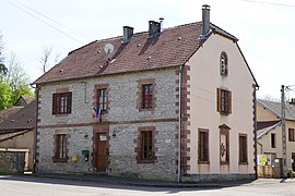 The town hall in Longevelle | |
 Coat of arms | |
show Location of Longevelle | |
 Longevelle | |
| Coordinates: 47°35′27″N 6°26′54″E / 47.5908°N 6.4483°ECoordinates: 47°35′27″N 6°26′54″E / 47.5908°N 6.4483°E | |
| Country | France |
| Region | Bourgogne-Franche-Comté |
| Department | Haute-Saône |
| Arrondissement | Lure |
| Canton | Villersexel |
| Government | |
| • Mayor (2020–2026) | Guy Saint Dizier[1] |
| Area 1 | 4.10 km2 (1.58 sq mi) |
| Population (Jan. 2018)[2] | 122 |
| • Density | 30/km2 (77/sq mi) |
| Time zone | UTC+01:00 (CET) |
| • Summer (DST) | UTC+02:00 (CEST) |
| INSEE/Postal code | 70307 /70110 |
| Elevation | 267–362 m (876–1,188 ft) |
| 1 French Land Register data, which excludes lakes, ponds, glaciers > 1 km2 (0.386 sq mi or 247 acres) and river estuaries. | |


Longevelle is a commune in the Haute-Saône département in the region of Bourgogne-Franche-Comté in eastern France.
See also[]
References[]
- ^ "Répertoire national des élus: les maires". data.gouv.fr, Plateforme ouverte des données publiques françaises (in French). 2 December 2020. Retrieved 7 December 2020.
- ^ "Populations légales 2018". INSEE. 28 December 2020.
| Wikimedia Commons has media related to Longevelle. |
This Haute-Saône geographical article is a stub. You can help Wikipedia by . |
Categories:
- Communes of Haute-Saône
- Haute-Saône geography stubs