Machault, Seine-et-Marne
Machault | |
|---|---|
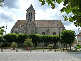 The church in Machault | |
 Coat of arms | |
show Location of Machault | |
 Machault | |
| Coordinates: 48°27′19″N 2°49′49″E / 48.4553°N 2.8303°ECoordinates: 48°27′19″N 2°49′49″E / 48.4553°N 2.8303°E | |
| Country | France |
| Region | Île-de-France |
| Department | Seine-et-Marne |
| Arrondissement | Melun |
| Canton | Nangis |
| Intercommunality | Brie des Rivières et Châteaux |
| Government | |
| • Mayor (2020–2026) | Christian Poteau[1] |
| Area 1 | 16.28 km2 (6.29 sq mi) |
| Population (Jan. 2018)[2] | 781 |
| • Density | 48/km2 (120/sq mi) |
| Time zone | UTC+01:00 (CET) |
| • Summer (DST) | UTC+02:00 (CEST) |
| INSEE/Postal code | 77266 /77133 |
| Elevation | 72–117 m (236–384 ft) |
| 1 French Land Register data, which excludes lakes, ponds, glaciers > 1 km2 (0.386 sq mi or 247 acres) and river estuaries. | |


Machault (French pronunciation: [maʃo] (![]() listen)) is a commune in the Seine-et-Marne département in the Île-de-France region in north-central France.
listen)) is a commune in the Seine-et-Marne département in the Île-de-France region in north-central France.
Population[]
| Year | Pop. | ±% |
|---|---|---|
| 2004 | 680 | — |
| 2006 | 685 | +0.7% |
| 2007 | 694 | +1.3% |
| 2008 | 702 | +1.2% |
| 2009 | 710 | +1.1% |
| 2010 | 722 | +1.7% |
| 2011 | 739 | +2.4% |
| 2012 | 755 | +2.2% |
| 2013 | 771 | +2.1% |
| 2014 | 787 | +2.1% |
| 2015 | 788 | +0.1% |
| 2016 | 785 | −0.4% |
Inhabitants are called Machauliens.
See also[]
- Communes of the Seine-et-Marne department
References[]
- ^ "Répertoire national des élus: les maires". data.gouv.fr, Plateforme ouverte des données publiques françaises (in French). 2 December 2020.
- ^ "Populations légales 2018". INSEE. 28 December 2020.
External links[]
| Wikimedia Commons has media related to Machault (Seine-et-Marne). |
- 1999 Land Use, from IAURIF (Institute for Urban Planning and Development of the Paris-Île-de-France région) (in English)
- Base Mérimée: Search for heritage in the commune, Ministère français de la Culture. (in French)
| show Communes of the Seine-et-Marne department |
|---|
| show Authority control |
|---|
This article related to a Seine-et-Marne location is a stub. You can help Wikipedia by . |
Categories:
- Communes of Seine-et-Marne
- Seine-et-Marne geography stubs