Magny-Danigon
Magny-Danigon | |
|---|---|
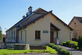 The town hall in Magny-Danigon | |
 Coat of arms | |
show Location of Magny-Danigon | |
 Magny-Danigon | |
| Coordinates: 47°40′32″N 6°36′12″E / 47.6756°N 6.6033°ECoordinates: 47°40′32″N 6°36′12″E / 47.6756°N 6.6033°E | |
| Country | France |
| Region | Bourgogne-Franche-Comté |
| Department | Haute-Saône |
| Arrondissement | Lure |
| Canton | Lure-2 |
| Area 1 | 7.52 km2 (2.90 sq mi) |
| Population (Jan. 2018)[1] | 436 |
| • Density | 58/km2 (150/sq mi) |
| Time zone | UTC+01:00 (CET) |
| • Summer (DST) | UTC+02:00 (CEST) |
| INSEE/Postal code | 70318 /70200 |
| Elevation | 302–463 m (991–1,519 ft) |
| 1 French Land Register data, which excludes lakes, ponds, glaciers > 1 km2 (0.386 sq mi or 247 acres) and river estuaries. | |


Magny-Danigon is a commune in the Haute-Saône department in the region of Bourgogne-Franche-Comté in eastern France.
See also[]
- Communes of the Haute-Saône department
- Arthur de Buyer Coal Mine is based in the commune.
References[]
- ^ "Populations légales 2018". INSEE. 28 December 2020.
| Wikimedia Commons has media related to Magny-Danigon. |
This Haute-Saône geographical article is a stub. You can help Wikipedia by . |
Categories:
- Communes of Haute-Saône
- Haute-Saône geography stubs