Oberon Council
| Oberon Council New South Wales | |||||||||||||||
|---|---|---|---|---|---|---|---|---|---|---|---|---|---|---|---|
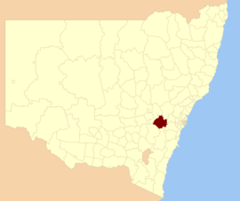 Location in New South Wales | |||||||||||||||
| Coordinates | 33°43′S 149°52′E / 33.717°S 149.867°ECoordinates: 33°43′S 149°52′E / 33.717°S 149.867°E | ||||||||||||||
| Population | |||||||||||||||
| • Density | 1.4490/km2 (3.7530/sq mi) | ||||||||||||||
| Area | 3,659 km2 (1,412.7 sq mi) | ||||||||||||||
| Mayor | Kathy Sajowitz (unaligned) | ||||||||||||||
| Council seat | Oberon[3] | ||||||||||||||
| Region | Central West | ||||||||||||||
| State electorate(s) | Bathurst | ||||||||||||||
| Federal Division(s) | Calare | ||||||||||||||
| Website | Oberon Council | ||||||||||||||
| |||||||||||||||

Oberon Council is a local government area in the Central West region of New South Wales, Australia.
The Mayor of Oberon Council is Cr. Kathy Sajowitz, an independent politician.
Localities[]
Oberon Council includes the towns / villages of Oberon, Black Springs, Shooters Hill, , O'Connell, Mount David, Jenolan and Burraga. It also includes the minor localities of Arkstone, Duckmaloi, Essington, Isabella and Porters Retreat.[4]
Heritage listings[]
The Oberon Council has a number of heritage-listed sites, including:
- Jenolan Caves Road: Jenolan Caves[5]
- Oberon, 124 Oberon Street: Malachi Gilmore Memorial Hall[6]
- Oberon, Tarana-Oberon railway: Oberon railway station[7]
Demographics[]
According to the Australian Bureau of Statistics there:[8]
- were 5,503 people as at 30 June 2006, the 125th largest Local Government Area in New South Wales. It was equal to less than 0.1% of the New South Wales population of 6,827,694
- was an increase of 60 people over the year to 30 June 2006, the 99th largest population growth in a Local Government Area in New South Wales. It was equal to 0.1% of the 58,753 increase in the population of New South Wales
- was, in percentage terms, an increase of 1.1% in the number of people over the year to 30 June 2006, the 41st fastest growth in population of a Local Government Area in New South Wales. In New South Wales the population grew by 0.9%
- was an increase in population over the 10 years to 30 June 2006 of 648 people or 13% (1.3% in annual average terms), the 32nd highest rate of a Local Government Area in New South Wales. In New South Wales the population grew by 622,966 or 10% (1.0% in annual average terms) over the same period.
Council[]
Current composition and election method[]
Oberon Council is composed of nine Councillors elected proportionally as a single ward. All Councillors are elected for a fixed four-year term of office. The Mayor is elected by the Councillors at the first meeting of the Council. The most recent election was held on 9 September 2017. The makeup of the Council is as follows:[9]
| Party | Councillors | |
|---|---|---|
| Independents and Unaligned | 9 | |
| Total | 9 | |
The current Council, elected in 2017, in order of result is:[9]
| Councillor | Party | Notes | |
|---|---|---|---|
| Kathy Sajowitz | Independent | Mayor | |
| Mick McKechnie | Unaligned | ||
| Kerry Gibbons | Unaligned | Deputy Mayor | |
| Clive McCarthy | Independent | ||
| Mark Kellam | Independent | ||
| Andrew McKibbin | Unaligned | ||
| Don Capel | Unaligned | ||
| Brenda Lyon | Independent | ||
| Ian Doney | Unaligned | ||
References[]
- ^ Australian Bureau of Statistics (27 June 2017). "Oberon (A)". 2016 Census QuickStats. Retrieved 7 July 2017.

- ^ "3218.0 – Regional Population Growth, Australia, 2017-18". Australian Bureau of Statistics. 27 March 2019. Retrieved 27 March 2019. Estimated resident population (ERP) at 30 June 2018.
- ^ "Oberon Council". Division of Local Government. Retrieved 9 November 2006.
- ^ "Oberon Council Strategic Planning Statement" (PDF). Oberon Council. May 2020. Retrieved 13 June 2021.
- ^ "Jenolan Caves Reserve". New South Wales State Heritage Register. Office of Environment and Heritage. H01698. Retrieved 18 May 2018.
- ^ "Malachi Gilmore Memorial Hall". New South Wales State Heritage Register. Office of Environment and Heritage. H01680. Retrieved 18 May 2018.
- ^ "Oberon Railway Station group". New South Wales State Heritage Register. Office of Environment and Heritage. H01215. Retrieved 18 May 2018.
- ^ "Regional Population Growth, Australia, 2005-06 (catalogue no.: 3218.0)". Australian Bureau of Statistics. Retrieved 12 March 2007.
- ^ Jump up to: a b "Summary of Group and Candidate First Preference Votes". Local Government Elections 2012. Electoral Commission of New South Wales. 8 September 2012. Retrieved 17 October 2012.
- Oberon Council
- Local government areas of New South Wales