Okaloosa County, Florida
Coordinates: 30°41′15″N 86°35′33″W / 30.68750°N 86.59250°W

Okaloosa County | |
|---|---|
U.S. county | |
 The Okaloosa County courthouse in March 2008 | |
 Flag  Seal | |
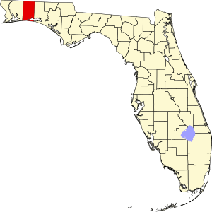 Location within the U.S. state of Florida | |
 Florida's location within the U.S. | |
| Coordinates: 30°41′15″N 86°35′33″W / 30.6875°N 86.5925°W | |
| Country | |
| State | |
| Founded | September 7, 1915 |
| Seat | Crestview |
| Largest city | Crestview |
| Area | |
| • Total | 1,082 sq mi (2,800 km2) |
| • Land | 930 sq mi (2,400 km2) |
| • Water | 152 sq mi (390 km2) 14.0%% |
| Population | |
| • Estimate (2019) | 210,738 |
| • Density | 227/sq mi (88/km2) |
| Time zone | UTC−6 (Central) |
| • Summer (DST) | UTC−5 (CDT) |
| Congressional district | 1st |
| Website | www |
Okaloosa County is located in the northwestern portion of the U.S. state of Florida, extending from the Gulf of Mexico to the Alabama state line. As of the 2010 census, the population was 180,822.[1] Its county seat is Crestview.[2]
Okaloosa County is included in the Crestview-Fort Walton Beach-Destin, FL Metropolitan Statistical Area.
History[]
Okaloosa County was created by an act passed on September 7, 1915,[3] formed from the eastern ranges of Santa Rosa County and the western ranges of Walton County.
Okaloosa is a Choctaw word meaning "black water"; oka means "water" and lusa means "black" in the Choctaw language.[4]
Geography[]
According to the U.S. Census Bureau, the county has a total area of 1,082 square miles (2,800 km2), of which 930 square miles (2,400 km2) is land and 152 square miles (390 km2) (14.0%) is water.[5] Fort Walton Beach and three United States Air Force bases, (Duke Field in the North and Eglin AFB and Hurlburt Field are in the south).
Adjacent counties[]
- Covington County, Alabama - north
- Walton County, Florida - east
- Santa Rosa County, Florida - west
- Escambia County, Alabama - northwest
National protected areas[]
- Choctawhatchee National Forest (part)
- Gulf Islands National Seashore (part)

State Parks and Forests[]
- Blackwater River State Forest:[6] 189,594 acres (76,726 ha) spanning Okaloosa and neighboring Santa Rosa County.[7]
- Fred Gannon Rocky Bayou State Recreation Area:[8] 357 acres (144 ha) of sand pine forest along Choctawhatchee Bay. The park provides facilities for camping, hiking, fishing, and canoeing. It is located five miles (8 km) east of Niceville on State Road 20.[9]
- Henderson Beach State Park:[10] 1.3 miles (2.1 km) of sugar sand beach along the Gulf of Mexico. The park provides facilities for camping, RV-ing, and picnicking, as well as a pavilion and boardwalk. It is located just east of downtown Destin on U.S. 98.[9]
Demographics[]
| Historical population | |||
|---|---|---|---|
| Census | Pop. | %± | |
| 1920 | 9,360 | — | |
| 1930 | 9,897 | 5.7% | |
| 1940 | 12,900 | 30.3% | |
| 1950 | 27,533 | 113.4% | |
| 1960 | 61,175 | 122.2% | |
| 1970 | 88,187 | 44.2% | |
| 1980 | 109,920 | 24.6% | |
| 1990 | 143,776 | 30.8% | |
| 2000 | 170,498 | 18.6% | |
| 2010 | 180,822 | 6.1% | |
| 2019 (est.) | 210,738 | 16.5% | |
| U.S. Decennial Census[11] 1790-1960[12] 1900-1990[13] 1990-2000[14] 2010-2015[1] 2019[15] | |||
As of 2015,[16] there were 198,664 people and 95,494 households. As of the census of 2010,the population density was 194.4 people per square mile (70/km2).
Link to statistics of racial makeup:[1]
- White alone=81.5% (July 1, 2015)
- Black or African American alone=10.2% (July 1, 2015)
- American Native and Alaskan Native alone=0.7% (July 1, 2015)
- Asian alone=3.2% (July 1, 2015)
- Native Hawaiian and Other Pacific Islander alone=0.3% (July 1, 2015)
- Two or more races=4.1% (July 1, 2015)
- Hispanic or Latino=8.6% (July 1, 2015)
As of 2015, there were 95,494 households. Within the 2010 census, 33.10% had children under the age of 18 living with them, 56.20% were married couples living together, 10.20% had a female householder with no husband present, and 29.80% were non-families. 23.50% of all households were made up of individuals, and 7.50% had someone living alone who was 65 years of age or older. The average household size was 2.49 and the average family size was 2.94.
According to the 2010 census, the population was spread out, with 24.70% under the age of 18, 9.60% from 18 to 24, 31.10% from 25 to 44, 22.40% from 45 to 64, and 12.10% who were 65 years of age or older. The median age was 36 years. For every 100 females there were 102.20 males. For every 100 females age 18 and over, there were 101.50 males.
In 2015, the median income for a household in the county was $55,880. The per capita income for the county was $28,902. 11.3% of the population were below the poverty line.
Education[]
The county's public schools come under the Okaloosa County School District.
Northwest Florida State College serves over 10,000 residents of Okaloosa County annually for bachelor's degrees, associate degrees, and certificates. The college maintains four campuses in Okaloosa County: Niceville, Crestview, Ft. Walton Beach, and Hurlburt Field, and one campus in Walton County, FL.
Libraries[]
Okaloosa County is served by the Okaloosa County Public Library Cooperative. Formed in October 1997, the Cooperative originally included the county and the cities of Crestview, Mary Esther, and Niceville. The cities of Fort Walton Beach, Valparaiso, and Destin all joined the Cooperative by the year 2000.[17] The Okaloosa County Public Library Cooperative is governed by an independent inter-governmental agency with 7 members and 6 alternates. Current Governing Board members include Nathan Boyles representing Okaloosa County, Shannon Hayes representing the City of Crestview, Florida, Rodney Braden representing the City of Destin, Florida, Amy Jamieson representing the City of Fort Walton Beach, Florida, Bernie Oder representing the City of Mary Esther, Florida, Bill Schaetzle representing the City of Niceville, Florida, and Kay Hamilton representing the City of Valparaiso, Florida.[18]
Libraries in the Cooperative operate with a combination of County funding, distributed according to library productivity and municipal expenditure, and funding from each respective city. All libraries in the Cooperative offer computers and wireless access for public use, books and other items for physical checkout, and access to e-books, audiobooks, and digital magazines for checkout via Overdrive and RBDigital with a library card. The Cooperative partners with the Florida Department of Children and Families for social services registration, the Right Service at the Right Time Archived 2020-05-02 at the Wayback Machine guide for local assistance resources, and the Florida Division of Elections for voter registration assistance.[17] Other services the Cooperative offers include a career center, job fairs, career counseling, income tax preparation, homework assistance and tutoring, meeting rooms, study spaces, classes and cultural events for children and adults, research assistance (including assistance with genealogy research), and digital media creation labs.
The Robert L.F. Sikes Library is located in Crestview, FL and was started in the 1940s in the home of local resident Bertha Henry. She started the library using books that belonged to her, her mother, and the lending library at Crestview's Episcopal Church of the Epiphany. After moving locations multiple times as it grew, the library was eventually renamed after Congressman Robert “Bob” Sikes, who served in Congress from 1940 to 1979.
The Destin Library is located in Destin, FL. They provide many services to the public including ancestry research, online card catalog training and how to check out and utilize ebooks using the library.
The Fort Walton Beach Library is located in Fort Walton Beach, FL. It was established in 1927 by the Women's Club in an old Masonic building near the waterfront of the city. In order to keep the library open, they would rotate services during the days of the week, each service offered on a particular day of the week. The library ended up closing to the public after donating all of its inventory to the local high school to help them meet their requirements to the students. In 1954, the Business and Professional Women's Club helped the Women's Club to re-establish the public library, and it is thriving today.
The Mary Esther Public Library was first proposed in 1974 and was approved, taking up only a space of 585 square feet. After a new building was provided in 1988, the library's popularity and utilization continued to grow. In 1990, a grant was approved to construct a brand new library and it was opened to the public in 1992. In 2004, the library was expanded and it thrives today serving the citizens of Mary Esther, FL and Okaloosa County.
The Niceville Library became a part of the library cooperative in 1997 in Okaloosa County. The library buildings include the main public library, a community center that hosts events and a public children's park and splash pad.
The Valparaiso Community Library is located in Valparaiso, FL. It began in 1973 with a modest collection. Eventually it expanded to include genealogy research which helped to expand its collection. In 2007 the library was awarded a state library construction grant. While it is one of the smaller libraries, it continues to provide the same type of services to the community.
Transportation[]
Airports[]
Surface Transportation[]
Emerald Coast Rider (formerly Okaloosa County Transit)[19] operates bus services in the county.[20]

Politics[]
Okaloosa County is one of the most conservative counties in Florida. Incumbent George W. Bush won the county in 2004 with 78% of the popular vote and in 2008 the Republican candidate John McCain polled 72%.[21] Mitt Romney won the county in 2012 with 73.86% (69,785) of the popular vote, while Donald Trump won 70.42% (71,893) in 2016. A testament to how conservative Okaloosa County is, Donald Trump won 51 out of 52 voting precincts in the county.[22]
Communities[]
Cities[]
- Crestview
- Destin
- Fort Walton Beach
- Laurel Hill
- Mary Esther
- Niceville
- Valparaiso
Towns[]
- Cinco Bayou
- Shalimar
Census-designated places[]
- Eglin AFB
- Lake Lorraine
- Ocean City
- Wright
Other unincorporated communities[]
See also[]
References[]
- ^ Jump up to: a b "State & County QuickFacts". United States Census Bureau. Retrieved February 14, 2014.[permanent dead link]
- ^ "Find a County". National Association of Counties. Archived from the original on May 31, 2011. Retrieved June 7, 2011.
- ^ Hutchinson, Leonard Patrick, "History of the Playground Area of Northwest Florida", Great Outdoors Publishing Co., St. Petersburg, Florida, 1st ed., 1961, no Library of Congress card number, no ISBN, page 41.
- ^ Read, William (2008). Louisiana Place Names of Indian Origin: A Collection of Words. Tuscaloosa, Alabama: The University of Alabama Press. p. 47. ISBN 978-0-8173-8072-4.
- ^ "US Gazetteer files: 2010, 2000, and 1990". United States Census Bureau. February 12, 2011. Retrieved April 23, 2011.
- ^ "Florida State Parks".
- ^ McGovern, Bernie (2011). Florida Almanac 2012. Pelican Publishing Company. p. 186. ISBN 9781589808461.
- ^ "Florida State Parks".
- ^ Jump up to: a b McGovern, Bernie (2011). Florida Almanac 2012. Pelican Publishing Company. p. 214. ISBN 9781589808461.
- ^ "Florida State Parks".
- ^ "U.S. Decennial Census". United States Census Bureau. Retrieved June 16, 2014.
- ^ "Historical Census Browser". University of Virginia Library. Retrieved June 16, 2014.
- ^ "Population of Counties by Decennial Census: 1900 to 1990". United States Census Bureau. Retrieved June 16, 2014.
- ^ "Census 2000 PHC-T-4. Ranking Tables for Counties: 1990 and 2000" (PDF). United States Census Bureau. Retrieved June 16, 2014.
- ^ "QuickFacts. Florida counties". Retrieved May 20, 2020.
- ^ "U.S. Census website". United States Census Bureau. Retrieved May 14, 2011.
- ^ Jump up to: a b Okaloosa County Library Cooperative. (2011). Introduction to the Okaloosa County Library Cooperative. Retrieved from https://www.cityofdestin.com/DocumentCenter/View/602/Introduction-to-Okaloosa-County-Public-Library-Cooperative
- ^ Okaloosa County Public Library Cooperative. (2018). About Us. Retrieved from https://readokaloosa.org/client/en_US/default/?rm=ABOUT US0%7C%7C%7C1%7C%7C%7C0%7C%7C%7Ctrue
- ^ "Welcome to Emerald Coast Rider". Emerald Coast Rider. 2015. Archived from the original on November 1, 2015. Retrieved December 16, 2017.
- ^ "Ride The Wave! - EC Rider". www.ecrider.org. Retrieved December 16, 2017.
- ^ "2008 US Presidential Election Results by County - USATODAY.com". Content.usatoday.com. November 10, 2008. Retrieved July 22, 2010.
- ^ https://uselectionatlas.org/RESULTS/
- ^ Leip, David. "Dave Leip's Atlas of U.S. Presidential Elections".
External links[]
| Wikimedia Commons has media related to Okaloosa County, Florida. |
Government links/Constitutional offices[]
- Okaloosa County Board of County Commissioners
- Okaloosa County Clerk of Court
- Okaloosa County Supervisor of Elections
- Okaloosa County Property Appraiser
- Okaloosa County Sheriff's Office
- Okaloosa County Tax Collector
- Okaloosa County Census
- https://www.census.gov/quickfacts/table/HSG010215/12091
Special districts[]
Judicial branch[]
- Okaloosa County Clerk of Courts Archived 2004-12-30 at the Wayback Machine
- Public Defender, 1st Judicial Circuit of Florida serving Escambia, Santa Rosa, Okaloosa, and Walton counties
- Office of the State Attorney, 1st Judicial Circuit of Florida
- Circuit and County Court for the 1st Judicial Circuit of Florida
Tourism links[]
Media links[]
| show Places adjacent to Okaloosa County, Florida |
|---|
| show Municipalities and communities of Okaloosa County, Florida, United States |
|---|


| show Authority control |
|---|
- Florida counties
- Okaloosa County, Florida
- 1915 establishments in Florida
- Populated places established in 1915
- North Florida