Pernštejnské Jestřabí
Pernštejnské Jestřabí | |
|---|---|
Municipality | |
 Center of the village | |
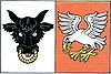 Flag  Coat of arms | |
 Pernštejnské Jestřabí | |
| Coordinates: 49°24′30″N 16°19′28″E / 49.40833°N 16.32444°ECoordinates: 49°24′30″N 16°19′28″E / 49.40833°N 16.32444°E | |
| Country | |
| Region | South Moravian |
| District | Brno-Country |
| Area | |
| • Total | 7.5 km2 (2.9 sq mi) |
| Elevation | 485 m (1,591 ft) |
| Population (2006) | |
| • Total | 177 |
| • Density | 24/km2 (61/sq mi) |
| Postal code | 592 61 |
| Website | http://www.pernstejnskejestrabi.cz/ |

Pernštejnské Jestřabí is a village and municipality (obec) in Brno-Country District in the South Moravian Region of the Czech Republic.
The municipality covers an area of 7.5 square kilometres (2.9 sq mi), and has a population of 177 (as at 3 July 2006).
Pernštejnské Jestřabí lies approximately 32 kilometres (20 mi) north-west of Brno and 157 km (98 mi) south-east of Prague.
References[]
| Wikimedia Commons has media related to Pernštejnské Jestřabí. |
This South Moravian Region location article is a stub. You can help Wikipedia by . |
Categories:
- Villages in Brno-Country District
- South Moravian Region geography stubs