Plancher-les-Mines
show This article may be expanded with text translated from the corresponding article in French. (July 2014) Click [show] for important translation instructions. |
Plancher-les-Mines | |
|---|---|
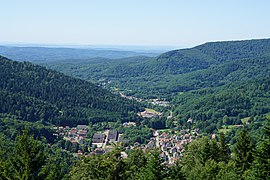 A general view of the village and the surrounding hills | |
show Location of Plancher-les-Mines | |
 Plancher-les-Mines | |
| Coordinates: 47°45′42″N 6°44′35″E / 47.7617°N 6.7431°ECoordinates: 47°45′42″N 6°44′35″E / 47.7617°N 6.7431°E | |
| Country | France |
| Region | Bourgogne-Franche-Comté |
| Department | Haute-Saône |
| Arrondissement | Lure |
| Canton | Héricourt-1 |
| Area 1 | 25.59 km2 (9.88 sq mi) |
| Population (Jan. 2018)[1] | 960 |
| • Density | 38/km2 (97/sq mi) |
| Time zone | UTC+01:00 (CET) |
| • Summer (DST) | UTC+02:00 (CEST) |
| INSEE/Postal code | 70414 /70290 |
| Elevation | 483–1,215 m (1,585–3,986 ft) |
| 1 French Land Register data, which excludes lakes, ponds, glaciers > 1 km2 (0.386 sq mi or 247 acres) and river estuaries. | |


Plancher-les-Mines is a commune in the Haute-Saône department in the region of Bourgogne-Franche-Comté in eastern France. It is a small village close to the ski station at La Planche des Belles Filles. There is one elementary school located near the church, and a small cinema.
See also[]
References[]
- ^ "Populations légales 2018". INSEE. 28 December 2020.
| Wikimedia Commons has media related to Plancher-les-Mines. |
| show Authority control |
|---|
This Haute-Saône geographical article is a stub. You can help Wikipedia by . |
Categories:
- Communes of Haute-Saône
- Haute-Saône geography stubs