Raddon-et-Chapendu
Raddon-et-Chapendu | |
|---|---|
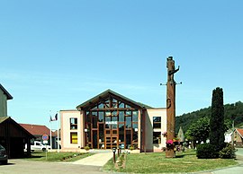 The town hall in Raddon-et-Chapendu | |
 Coat of arms | |
show Location of Raddon-et-Chapendu | |
 Raddon-et-Chapendu | |
| Coordinates: 47°50′33″N 6°28′19″E / 47.8425°N 6.4719°ECoordinates: 47°50′33″N 6°28′19″E / 47.8425°N 6.4719°E | |
| Country | France |
| Region | Bourgogne-Franche-Comté |
| Department | Haute-Saône |
| Arrondissement | Lure |
| Canton | Mélisey |
| Intercommunality | |
| Government | |
| • Mayor (2020–2026) | Joël Brice[1] |
| Area 1 | 12.50 km2 (4.83 sq mi) |
| Population (Jan. 2018)[2] | 846 |
| • Density | 68/km2 (180/sq mi) |
| Time zone | UTC+01:00 (CET) |
| • Summer (DST) | UTC+02:00 (CEST) |
| INSEE/Postal code | 70435 /70280 |
| Elevation | 319–497 m (1,047–1,631 ft) |
| 1 French Land Register data, which excludes lakes, ponds, glaciers > 1 km2 (0.386 sq mi or 247 acres) and river estuaries. | |


Raddon-et-Chapendu is a commune in the Haute-Saône department in the region of Bourgogne-Franche-Comté in eastern France.
Population[]
| Year | Pop. | ±% |
|---|---|---|
| 2006 | 895 | — |
| 2007 | 890 | −0.6% |
| 2008 | 900 | +1.1% |
| 2009 | 915 | +1.7% |
| 2010 | 930 | +1.6% |
| 2011 | 945 | +1.6% |
| 2012 | 953 | +0.8% |
| 2013 | 954 | +0.1% |
| 2014 | 925 | −3.0% |
| 2015 | 896 | −3.1% |
| 2016 | 867 | −3.2% |
See also[]
References[]
- ^ "Répertoire national des élus: les maires". data.gouv.fr, Plateforme ouverte des données publiques françaises (in French). 2 December 2020. Retrieved 7 December 2020.
- ^ "Populations légales 2018". INSEE. 28 December 2020.
| Wikimedia Commons has media related to Raddon-et-Chapendu. |
This Haute-Saône geographical article is a stub. You can help Wikipedia by . |
Categories:
- Communes of Haute-Saône
- Haute-Saône geography stubs