Saint-Soupplets
Saint-Soupplets | |
|---|---|
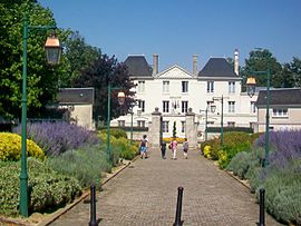 The town hall in Saint-Soupplets | |
 Coat of arms | |
show Location of Saint-Soupplets | |
 Saint-Soupplets | |
| Coordinates: 49°02′21″N 2°48′28″E / 49.0393°N 2.8077°ECoordinates: 49°02′21″N 2°48′28″E / 49.0393°N 2.8077°E | |
| Country | France |
| Region | Île-de-France |
| Department | Seine-et-Marne |
| Arrondissement | Meaux |
| Canton | Claye-Souilly |
| Intercommunality | CA Pays de Meaux |
| Government | |
| • Mayor (2020–2026) | Stéphane Devauchelle |
| Area 1 | 13.78 km2 (5.32 sq mi) |
| Population (Jan. 2018)[1] | 3,233 |
| • Density | 230/km2 (610/sq mi) |
| Time zone | UTC+01:00 (CET) |
| • Summer (DST) | UTC+02:00 (CEST) |
| INSEE/Postal code | 77437 /77165 |
| Elevation | 88–179 m (289–587 ft) |
| 1 French Land Register data, which excludes lakes, ponds, glaciers > 1 km2 (0.386 sq mi or 247 acres) and river estuaries. | |


Saint-Soupplets (French pronunciation: [sɛ̃ suplɛ] (![]() listen)) is a commune in the Seine-et-Marne department in the Île-de-France region in north-central France.
listen)) is a commune in the Seine-et-Marne department in the Île-de-France region in north-central France.
Demographics[]
Inhabitants of Saint-Soupplets are called Saint-Sulpiciens.
See also[]
- Communes of the Seine-et-Marne department
References[]
- ^ "Populations légales 2018". INSEE. 28 December 2020.
External links[]
| Wikimedia Commons has media related to Saint-Soupplets. |
- 1999 Land Use, from IAURIF (Institute for Urban Planning and Development of the Paris-Île-de-France région) (in English)
| show Communes of the Seine-et-Marne department |
|---|
| show Authority control |
|---|
This article related to a Seine-et-Marne location is a stub. You can help Wikipedia by . |
Categories:
- Communes of Seine-et-Marne
- Seine-et-Marne geography stubs