Vendrest
Vendrest | |
|---|---|
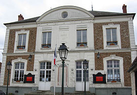 The town hall in Vendrest | |
show Location of Vendrest | |
 Vendrest | |
| Coordinates: 49°02′50″N 3°05′41″E / 49.0472°N 3.0947°ECoordinates: 49°02′50″N 3°05′41″E / 49.0472°N 3.0947°E | |
| Country | France |
| Region | Île-de-France |
| Department | Seine-et-Marne |
| Arrondissement | Meaux |
| Canton | La Ferté-sous-Jouarre |
| Intercommunality | Pays de l'Ourcq |
| Government | |
| • Mayor (2020–2026) | Francis Chesné[1] |
| Area 1 | 17.73 km2 (6.85 sq mi) |
| Population (Jan. 2018)[2] | 713 |
| • Density | 40/km2 (100/sq mi) |
| Time zone | UTC+01:00 (CET) |
| • Summer (DST) | UTC+02:00 (CEST) |
| INSEE/Postal code | 77490 /77440 |
| Elevation | 66–206 m (217–676 ft) |
| 1 French Land Register data, which excludes lakes, ponds, glaciers > 1 km2 (0.386 sq mi or 247 acres) and river estuaries. | |


Vendrest is a commune in the Seine-et-Marne department in the Île-de-France region in north-central France.
Demographics[]
Inhabitants of Vendrest are called Vendrestois.
See also[]
- Communes of the Seine-et-Marne department
References[]
- ^ "Répertoire national des élus: les maires". data.gouv.fr, Plateforme ouverte des données publiques françaises (in French). 2 December 2020.
- ^ "Populations légales 2018". INSEE. 28 December 2020.
| Wikimedia Commons has media related to Vendrest. |
| show Communes of the Seine-et-Marne department |
|---|
| show Authority control |
|---|
This article related to a Seine-et-Marne location is a stub. You can help Wikipedia by . |
Categories:
- Communes of Seine-et-Marne
- Seine-et-Marne geography stubs