Wiggins, Colorado
Town of Wiggins, Colorado | |
|---|---|
Town | |
 The Wiggins Municipal Building. | |
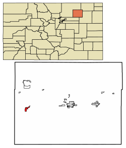 Location of Wiggins in Morgan County, Colorado. | |
| Coordinates: 40°13′49″N 104°4′24″W / 40.23028°N 104.07333°WCoordinates: 40°13′49″N 104°4′24″W / 40.23028°N 104.07333°W | |
| Country | |
| State | |
| County[1] | Morgan County |
| Established | 1882 |
| Incorporated | October 11, 1974[2] |
| Named for | Oliver P. Wiggins |
| Government | |
| • Type | Statutory Town[1] |
| Area | |
| • Total | 1.33 sq mi (3.44 km2) |
| • Land | 1.32 sq mi (3.43 km2) |
| • Water | 0.00 sq mi (0.01 km2) |
| Elevation | 4,557 ft (1,389 m) |
| Population (2010) | |
| • Total | 893 |
| • Estimate (2019)[6] | 1,163 |
| • Density | 879.06/sq mi (339.50/km2) |
| Time zone | UTC-7 (Mountain (MST)) |
| • Summer (DST) | UTC-6 (MDT) |
| ZIP code[5] | 80654 |
| Area code(s) | 970 |
| FIPS code | 08-84770 |
| GNIS feature ID | 0204698 |
| Website | Town website |

Wiggins is a Statutory Town in Morgan County, Colorado, United States. The population was 893 at the 2010 census.
The community was established in 1882 as the Burlington railroad depot of Corona. Around 1900, Corona was renamed in honor of Oliver P. Wiggins,[7] who served as a guide and scout for Captain John C. Frémont, on some of his explorations through northern Colorado in the 1840s. He also accompanied Kit Carson for 12 years on his expeditions. Technically, there is still a portion of the town which is Corona. It is the north side of the railroad tracks. The part to the east was named after Oliver P. Wiggins, and that is Wiggins. The whole town was never officially renamed.
Geography[]
According to the United States Census Bureau, the town has a total area of 0.9 square miles (2.3 km2), all of it land.[8]
Demographics[]
| Historical population | |||
|---|---|---|---|
| Census | Pop. | %± | |
| 1980 | 531 | — | |
| 1990 | 499 | −6.0% | |
| 2000 | 838 | 67.9% | |
| 2010 | 893 | 6.6% | |
| 2019 (est.) | 1,163 | [6] | 30.2% |
| U.S. Decennial Census[9] | |||
As of the census[10] of 2000, there were 838 people, 265 households, and 210 families residing in the town. The population density was 938.4 people per square mile (363.5/km2). There were 279 housing units at an average density of 312.4 per square mile (121.0/km2). The racial makeup of the town was 82.10% White, 1.19% African American, 2.27% Native American, 12.89% from other races, and 1.55% from two or more races. Hispanic or Latino of any race were 25.06% of the population.
There were 265 households, out of which 46.8% had children under the age of 18 living with them, 62.6% were married couples living together, 10.9% had a female householder with no husband present, and 20.4% were non-families. 17.0% of all households were made up of individuals, and 7.2% had someone living alone who was 65 years of age or older. The average household size was 3.16 and the average family size was 3.52.
The age of the town's population is spread out, with 37.0% under the age of 18, 7.8% from 18 to 24, 28.0% from 25 to 44, 19.6% from 45 to 64, and 7.6% who were 65 years of age or older. The median age was 30 years. For every 100 females, there were 100.5 males. For every 100 females age 18 and over, there were 98.5 males.
The median income for a household in the town was $33,438, and the median income for a family was $34,219. Males had a median income of $26,296 versus $20,833 for females. The per capita income for the town was $11,827. About 15.0% of families and 14.8% of the population were below the poverty line, including 16.1% of those under age 18 and none of those age 65 or over.
Education[]
Wiggins is home to the Wiggins RE-50J school district. The district includes Wiggins Elementary School, Wiggins Middle School and .
See also[]
- Outline of Colorado
- State of Colorado
- Colorado cities and towns
- Colorado municipalities
- Colorado counties
- Colorado metropolitan areas
- Fort Morgan, CO Micropolitan Statistical Area
- Colorado cities and towns
References[]
- ^ Jump up to: a b "Active Colorado Municipalities". State of Colorado, Department of Local Affairs. Retrieved 2007-09-01.
- ^ "Colorado Municipal Incorporations". State of Colorado, Department of Personnel & Administration, Colorado State Archives. 2004-12-01. Retrieved 2007-09-02.
- ^ "2019 U.S. Gazetteer Files". United States Census Bureau. Retrieved July 1, 2020.
- ^ "US Board on Geographic Names". United States Geological Survey. 2007-10-25. Retrieved 2008-01-31.
- ^ "ZIP Code Lookup" (JavaScript/HTML). United States Postal Service. Retrieved 2008-01-08.
- ^ Jump up to: a b "Population and Housing Unit Estimates". United States Census Bureau. May 24, 2020. Retrieved May 27, 2020.
- ^ Dawson, John Frank. Place names in Colorado: why 700 communities were so named, 150 of Spanish or Indian origin. Denver, CO: The J. Frank Dawson Publishing Co. p. 52.
- ^ "US Gazetteer files: 2010, 2000, and 1990". United States Census Bureau. 2011-02-12. Retrieved 2011-04-23.
- ^ "Census of Population and Housing". Census.gov. Retrieved June 4, 2015.
- ^ "U.S. Census website". United States Census Bureau. Retrieved 2008-01-31.
External links[]
| show Municipalities and communities of Morgan County, Colorado, United States |
|---|


| show Authority control |
|---|
- Towns in Morgan County, Colorado
- Towns in Colorado