Alexander 134B
Alexander 134B | |
|---|---|
| Alexander Indian Reserve No. 134B | |
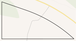 Boundaries of Alexander 134B | |
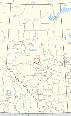 Location in Alberta | |
| First Nation | Alexander |
| Treaty | 8 |
| Country | Canada |
| Province | Alberta |
| Municipal district | Woodlands |
| Area | |
| • Total | 3.4 ha (8.4 acres) |
Alexander 134B is an Indian reserve of the Alexander First Nation in Alberta, within Woodlands County.[2] It is 36 kilometres northwest of Barrhead.[1]
See also[]
References[]
- ^ a b "Reserve/Settlement/Village Detail". Indigenous and Northern Affairs Canada. Government of Canada. Retrieved August 12, 2019.
- ^ a b Government of Alberta (2019). Municipal Boundaries (Map). AltaLIS.
| Ethnolinguistic groups | |||||||||||||||||||||||||||
|---|---|---|---|---|---|---|---|---|---|---|---|---|---|---|---|---|---|---|---|---|---|---|---|---|---|---|---|
| Historical polities |
| ||||||||||||||||||||||||||
| Numbered Treaties | |||||||||||||||||||||||||||
| Tribal councils and band governments |
| ||||||||||||||||||||||||||
Coordinates: 54°20′31″N 114°48′43″W / 54.341819°N 114.812007°W
This article about an Indian reserve in Alberta is a stub. You can help Wikipedia by . |
Categories:
- Indian reserves in Alberta
- Alberta Indian reserve stubs