Saddle Lake 125
Saddle Lake 125 | |
|---|---|
| Saddle Lake Indian Reserve No. 125 | |
 Boundaries of Saddle Lake 125 | |
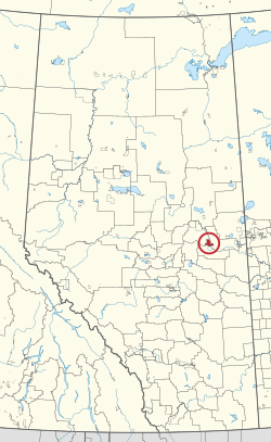 Location in Alberta | |
| First Nation | Saddle Lake |
| Treaty | 6 |
| Country | Canada |
| Province | Alberta |
| Municipal districts | Smoky Lake St. Paul |
| Area | |
| • Total | 25,780.6 ha (63,705.2 acres) |
Saddle Lake 125 is an Indian reserve of the Saddle Lake Cree Nation in Alberta, located between Smoky Lake County and the County of St. Paul No. 19.[3] It is 24 kilometres west of St. Paul.[1]
Uniquely in Alberta, the Saddle Lake Cree Nation did not give permission for Statistics Canada to enter Saddle Lake 125 during the 2016 Canadian Census, and the reserve went unenumerated.[2]
References[]
- ^ a b "Reserve/Settlement/Village Detail". Indigenous and Northern Affairs Canada. Government of Canada. Retrieved August 12, 2019.
- ^ a b "Census Profile, 2016 Census". Statistics Canada. February 8, 2017. Retrieved 2019-08-10.
- ^ Government of Alberta (May 25, 2019). Municipal Boundaries (Map). AltaLIS.
| Ethnolinguistic groups | |||||||||||||||||||||||||||
|---|---|---|---|---|---|---|---|---|---|---|---|---|---|---|---|---|---|---|---|---|---|---|---|---|---|---|---|
| Historical polities |
| ||||||||||||||||||||||||||
| Numbered Treaties | |||||||||||||||||||||||||||
| Tribal councils and band governments |
| ||||||||||||||||||||||||||
Coordinates: 53°58′15″N 111°41′15″W / 53.9709°N 111.6874°W

This article about an Indian reserve in Alberta is a stub. You can help Wikipedia by . |
Categories:
- Indian reserves in Alberta
- Alberta Indian reserve stubs