Fishing Lake Metis Settlement
Fishing Lake Metis Settlement
Packechawanis (Cree) | |
|---|---|
| Motto(s): "Our Land, Our Culture, Our People, Our Future" | |
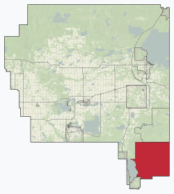 Location in M.D. of Bonnyville | |
 Fishing Lake Metis Settlement Location in Alberta | |
| Coordinates: 53°59′N 110°10′W / 53.983°N 110.167°WCoordinates: 53°59′N 110°10′W / 53.983°N 110.167°W | |
| Country | Canada |
| Province | Alberta |
| Region | Northern Alberta |
| Planning region | Lower Athabasca |
| Municipal district | Bonnyville No. 87 |
| Government | |
| • Chair | Wayne Daniels |
| • Self-Governing Metis Authority (Metis Settlements Act, 1990.) | Fishing Lake Métis Settlement Council, Métis Settlements General Council |
| Area (2016)[2] | |
| • Land | 355.51 km2 (137.26 sq mi) |
| Population (2016)[2] | |
| • Total | 446 |
| • Density | 1.3/km2 (3/sq mi) |
| Time zone | UTC−7 (MST) |
| • Summer (DST) | UTC−6 (MDT) |
| Website | flms.ca |

Fishing Lake Métis Settlement (Cree: Packechawanis) is a Métis settlement in northern Alberta, Canada within the Municipal District of Bonnyville No. 87 and Treaty Six lands. Fishing Lake Métis Settlement was settled by inhabitants of the dissolved St. Paul des Métis settlement and served as a historic Fishing camp to Métis in the region for centuries. It is home to many historical events such as the Frog Lake Resistance and is home to the beginning of the 20th century Métis movement as led by Charles Delorme, Jack Desjarlais and J.F Dion.[3] It is located approximately 15 km (9.3 mi) east of Highway 897 and 52 km (32 mi) south of Cold Lake.
Demographics[]
The population of the Fishing Lake Metis Settlement according to its 2018 municipal census is 436,[4] a decrease from its 2015 municipal census population count of 491.[5]
As a designated place in the 2016 Census of Population conducted by Statistics Canada, the Fishing Lake Métis Settlement recorded a population of 446 living in 160 of its 190 total private dwellings, a change of 2.3% from its 2011 population of 436. With a land area of 355.51 km2 (137.26 sq mi), it had a population density of 1.3/km2 (3.2/sq mi) in 2016.[2]
As a designated place in the 2011 Census, Fishing Lake had a population of 436 living in 153 of its 170 total dwellings, a change of −9.9% from its 2006 population of 484. With a land area of 355.74 km2 (137.35 sq mi), it had a population density of 1.2256/km2 (3.174/sq mi) in 2011.[6]
See also[]
References[]
- ^ "Municipal Officials Search". Alberta Municipal Affairs. May 9, 2019. Retrieved October 1, 2021.
- ^ a b c "Population and dwelling counts, for Canada, provinces and territories, and designated places, 2016 and 2011 censuses – 100% data (Alberta)". Statistics Canada. February 8, 2017. Retrieved February 9, 2017.
- ^ "Specialized and Rural Municipalities and Their Communities" (PDF). Alberta Municipal Affairs. 2012-11-05. Retrieved 2012-11-20.
- ^ "2019 Municipal Affairs Population List" (PDF). Alberta Municipal Affairs. December 2019. ISBN 978-1-4601-4623-1. Retrieved September 28, 2021.
- ^ "2016 Municipal Affairs Population List" (PDF). Alberta Municipal Affairs. ISBN 978-1-4601-3127-5. Retrieved September 28, 2021.
- ^ "Population and dwelling counts, for Canada, provinces and territories, and designated places, 2011 and 2006 censuses (Alberta)". Statistics Canada. 2012-02-08. Retrieved 2012-04-07.
External links[]
| Cities |
|
|---|---|
| Urban service areas |
|
| Towns |
|
| Villages | |
| Summer villages |
|
| Hamlets |
|
| Métis settlements |
|
| Municipal districts | |
| Specialized municipalities |
|
| Improvement districts | |
| Indian reserves |
|
| Other topics |
|
This Central Alberta location article is a stub. You can help Wikipedia by . |
- Municipal District of Bonnyville No. 87
- Métis settlements in Alberta
- Designated places in Alberta
- Central Alberta geography stubs