Wabasca 166
Wabasca 166 | |
|---|---|
| Wabasca Indian Reserve No. 166 | |
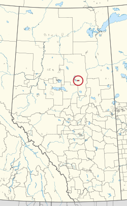 Location in Alberta | |
| First Nation | Bigstone Cree |
| Treaty | 8 |
| Country | Canada |
| Province | Alberta |
| Municipal district | Opportunity |
| Area | |
| • Total | 8,452.4 ha (20,886.3 acres) |
| Population (2016)[2] | |
| • Total | 2,500 |
| • Density | 30/km2 (77/sq mi) |
Wabasca 166 is an Indian reserve of the Bigstone Cree Nation in Alberta, located within the Municipal District of Opportunity No. 17.[3] It is 80 kilometres north of Slave Lake.[1] In the 2016 Canadian Census, it recorded a population of 160 living in 42 of its 49 total private dwellings.[2]
References[]
- ^ a b "Reserve/Settlement/Village Detail". Indigenous and Northern Affairs Canada. Government of Canada. Retrieved August 12, 2019.
- ^ a b "Census Profile, 2016 Census". Statistics Canada. February 8, 2017. Retrieved 2019-08-10.
- ^ Government of Alberta (2019). Municipal Boundaries (Map). AltaLIS.
| Ethnolinguistic groups | |||||||||||||||||||||||||||
|---|---|---|---|---|---|---|---|---|---|---|---|---|---|---|---|---|---|---|---|---|---|---|---|---|---|---|---|
| Historical polities |
| ||||||||||||||||||||||||||
| Numbered Treaties | |||||||||||||||||||||||||||
| Tribal councils and band governments |
| ||||||||||||||||||||||||||
Coordinates: 55°52′54″N 113°31′18″W / 55.8818°N 113.5218°W

This Northern Alberta location article is a stub. You can help Wikipedia by . |
This article about an Indian reserve in Alberta is a stub. You can help Wikipedia by . |
Categories:
- Indian reserves in Alberta
- Northern Alberta geography stubs
- Alberta Indian reserve stubs