Garden River, Alberta
Garden River
ᓂᐦᑖᐏᑭᐦᒋᑫᐤ ᓰᐲᓯᐢ nihtâwikihcikêw sîpîsis Garden Creek | |
|---|---|
Unincorporated community | |
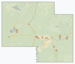 Garden River Location within Mackenzie County | |
| Coordinates: 58°42′50″N 113°53′31″W / 58.71389°N 113.89194°WCoordinates: 58°42′50″N 113°53′31″W / 58.71389°N 113.89194°W | |
| Country | Canada |
| Province | Alberta |
| Region | Northern Alberta |
| Planning region | Lower Peace |
| Improvement district | 24 |
| Returned to Little Red River Cree Nation[1] | June 19, 2017 |
| Area (2021)[2] | |
| • Land | 15.78 km2 (6.09 sq mi) |
| Population (2021)[2] | |
| • Total | 706 |
| • Density | 44.7/km2 (116/sq mi) |
| Time zone | UTC−07:00 (MST) |
| • Summer (DST) | UTC−06:00 (MDT) |
| Highways | Garden River Road |
| Waterways | Peace River |


Garden River, also known as Garden Creek (Cree: ᓂᐦᑖᐏᑭᐦᒋᑫᐤ ᓰᐲᓯᐢ, nihtâwikihcikêw sîpîsis), is an unincorporated community in northern Alberta, Canada within Wood Buffalo National Park. It is located on the north shore of the Peace River at the terminus of Garden River Road, an extension of Highway 58,[3] approximately 190 km (120 mi) east of the Town of High Level. It is a First Nations community of the Little Red River Cree Nation.[4]
History[]
Lying 5 kilometers inside the original 1922 boundary of Wood Buffalo National Park, this predominantly First Nations community was never officially recognized by the federal government, until a special amendment to the Canada National Parks Act removed the community from the park on June 19, 2017. Corresponding orders-in-council from the provincial government of Alberta are expected to facilitate the creation of a new Indian reserve encompassing Garden River's territory. This would become the third reserve of the Little Red River Cree Nation, after Fox Lake 162 and John D'Or Prairie 215.[1]
Demographics[]
In the 2021 Census of Population conducted by Statistics Canada, Garden River recorded a population of 706 living in 113 of its 133 total private dwellings, a change of 9.8% from its 2016 population of 643. With a land area of 15.78 km2 (6.09 sq mi), it had a population density of 44.7/km2 (115.9/sq mi) in 2021.[2]
Most of the residents speak Woods Cree at home.[citation needed]
See also[]
References[]
- ^ a b French, Janet (July 14, 2017). "Northern parkland returned to Alberta First Nation after 95 years". Edmonton Journal.
- ^ a b c "Population and dwelling counts: Canada and designated places". Statistics Canada. February 9, 2022. Retrieved February 10, 2022.
- ^ "Highway construction ramps up in northern Alberta". Alberta Transportation. 2009-05-28. Retrieved 2010-12-31.
- ^ "LRRCN Profile – Community". Little Red River Cree Nation. Archived from the original on 2011-07-06. Retrieved 2010-12-31.
External links[]
| Towns |
|
|---|---|
| Hamlets |
|
| Métis settlements |
|
| Municipal districts | |
| Specialized municipalities |
|
| Improvement districts |
|
| Indian reserves |
|
| National parks |
|
| Provincial parks | |
| Other topics |
|
This Northern Alberta location article is a stub. You can help Wikipedia by . |
- Cree
- Designated places in Alberta
- First Nations in Alberta
- Unincorporated communities in Alberta
- Northern Alberta geography stubs