Tthejëre Ghaı̨lı̨ 196B
Tthejëre Ghaı̨lı̨ 196B
Salt River[1] | |
|---|---|
| Tthejëre Ghaı̨lı̨ Indian Reserve No. 196B | |
 Boundaries of Tthejëre Ghaı̨lı̨ 196B | |
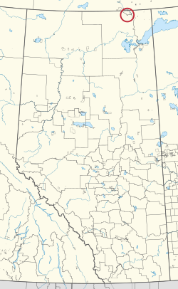 Location in Alberta | |
| First Nation | Smith's Landing |
| Treaty | 8 |
| Country | Canada |
| Province | Alberta |
| Specialized municipality | Wood Buffalo |
| Area | |
| • Total | 401.1 ha (991.1 acres) |
Tthejëre Ghaı̨lı̨ 196B, also known as Salt River, is an Indian reserve of the Smith's Landing First Nation in Alberta, located within the Regional Municipality of Wood Buffalo.[4][2]
References[]
- ^ "Reserve Sites.docx". Retrieved August 13, 2019.
- ^ a b "Reserve/Settlement/Village Detail". Indigenous and Northern Affairs Canada. Government of Canada. Retrieved August 12, 2019.
- ^ "Census Profile, 2016 Census". Statistics Canada. February 8, 2017. Retrieved 2019-08-10.
- ^ Government of Alberta (May 25, 2019). Municipal Boundaries (Map). AltaLIS.
| Ethnolinguistic groups | |||||||||||||||||||||||||||
|---|---|---|---|---|---|---|---|---|---|---|---|---|---|---|---|---|---|---|---|---|---|---|---|---|---|---|---|
| Historical polities |
| ||||||||||||||||||||||||||
| Numbered Treaties | |||||||||||||||||||||||||||
| Tribal councils and band governments |
| ||||||||||||||||||||||||||
Coordinates: 59°49′08″N 111°55′44″W / 59.8188°N 111.9289°W

This article about an Indian reserve in Alberta is a stub. You can help Wikipedia by . |
This Northern Alberta location article is a stub. You can help Wikipedia by . |
Categories:
- Indian reserves in Alberta
- Alberta Indian reserve stubs
- Northern Alberta geography stubs