Blood 148
Blood 148 | |
|---|---|
| Blood Indian Reserve No. 148 | |
 James Gladstone on his combine harvester | |
 Flag  Coat of arms | |
 Location in Alberta | |
| First Nation | Kainai Nation |
| Country | Canada |
| Province | Alberta |
| Municipal district | Cardston |
| Headquarters | Stand Off |
| Government | |
| • Body | Blood Tribe Council |
| • Chief | Roy Fox |
| Area | |
| • Total | 1,413.87 km2 (545.90 sq mi) |
| Population (2016)[1] | |
| • Total | 12,027 |
| Time zone | UTC−7 (MST) |
| • Summer (DST) | UTC−6 (MDT) |
| Highways | Highway 2 |
| Website | bloodtribe |
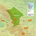
Blood 148 is a First Nations reserve in Alberta, Canada. It is inhabited by the Blood (Kainai) First Nation and was established under the provisions of Treaty 7.[2] This reserve is managed from the town of Stand Off on its northwest border and encompasses the majority of lands bounded by the cities of Fort MacLeod, Lethbridge and Cardston. It is traversed by Alberta Highway 2, Highway 5 and Highway 509. The St Mary River and the Belly River are major rivers supplying and draining the lands.
At 1,413.87 km2 (545.90 sq mi), this is the largest reserve in Canada, and the third most populous after Six Nations and Akwesasne. On June 12, 2019, federal courts ruled that, according to the land entitlement provisions of Treaty 7, the Blood Tribe was entitled to a reserve equal to 710 square miles (1,800 km2) in area,[3] an increase of 164.1 square miles (425 km2) over the existing lands. The judgement did not address remedy nor costs. It is located between the Cities of Fort MacLeod and Lethbridge and the Town of Cardston, bordering the Municipal District of Willow Creek No. 26 to the northwest, the Lethbridge County to the northeast and Cardston County to the east, south and southwest.
Demographics[]
In 2006, Blood 148 had a population of 4,177 living in 1,250 dwellings, an 8.4% increase from 2001. The Alberta Government lists the Blood 148 population at 4,713 in 2018. Prior to the June 12, 2019 award the Indian reserve land area was 1,413.87 km2 (545.90 sq mi), with a population density of 3.0/km2 (7.8/sq mi).[1] As of December 2013, the Blood 435 band, based on reserves 148 and 148A, had a total registered population of 11,791[4] per AANDC sources.
Government[]
Under the Constitution Act, 1867, legislative authority over Indian reserves is placed exclusively with the national parliament and specifically Crown–Indigenous Relations and Northern Affairs Canada. The reserve is governed by a tribal council led by Chief Roy Fox (2016–present).[5][6]
Blood Tribe Councillors (2019)[7]
- Dorothy First Rider (Itoomomaahkaa – Front Runner)
- Floyd Big Head (Piitaika’tsis – Eagle Arrow)
- Kyla Crow (Komiikakato’saakii – Round Star Woman)
- Martin Heavy Head (Ponokaiksikksinamm – White Elk)
- Joanne Lemieux (Aahkoyinnimaakii – Pipe Woman)
- Robin Little Bear (Soyiikayaakii – Mink Woman)
- Kirby Many Fingers (Apanssaapii – Counting Cue)
- Hank Shade (Aapiisii – Coyote)
- Lance Tailfeathers (Naatsikapoikkanaa – Two Stars Shining)
- Tim Tailfeathers (Naato’kisikapiohkitopiyi – Rides Two Grey Horse)
- Marcel Weasel Head (Niitsayoohkiitohkitopiyi)
- Franklyn White Quills (Makoyaapii – Wolf Old Man)
See also[]
- Beverly Hungry Wolf, writer
- List of Indian reserves in Alberta
References[]
- ^ Jump up to: a b Statistics Canada. "Canada 2006 Census: Blood 148 - Community Profile". Retrieved 2007-09-24.
- ^ Canada Indian and Northern Affairs. "First Nations in Alberta" (PDF). Retrieved 2007-09-24.
- ^ The Blood Reserve Number 148 et al v Her Majesty The Queen (June 12, 2019).Text
- ^ Blood Tribe registered population - AANDC - "Archived copy". Archived from the original on 2014-02-01. Retrieved 2014-01-23.CS1 maint: archived copy as title (link)
- ^ Blood Tribe Chief and Council web page - "Archived copy". Archived from the original on 2014-01-24. Retrieved 2014-02-08.CS1 maint: archived copy as title (link)
- ^ Blood Tribe. "Council". Archived from the original on 2013-10-05. Retrieved 2007-09-24.
- ^ "Chief and Council". Blood Tribe. Retrieved April 13, 2019.
External links[]
Coordinates: 49°30′N 113°12′W / 49.5°N 113.2°W
- Indian reserves in Alberta


