Ambrières-les-Vallées
Ambrières-les-Vallées | |
|---|---|
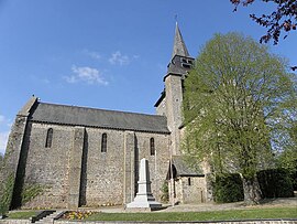 The church of Our Lady, in Ambrières-les-Vallées | |
 Coat of arms | |
show Location of Ambrières-les-Vallées | |
 Ambrières-les-Vallées | |
| Coordinates: 48°24′11″N 0°37′46″W / 48.4031°N 0.6294°WCoordinates: 48°24′11″N 0°37′46″W / 48.4031°N 0.6294°W | |
| Country | France |
| Region | Pays de la Loire |
| Department | Mayenne |
| Arrondissement | Mayenne |
| Canton | Gorron |
| Intercommunality | |
| Government | |
| • Mayor (2020–2026) | Guy Menard |
| Area 1 | 38.78 km2 (14.97 sq mi) |
| Population (Jan. 2018)[1] | 2,689 |
| • Density | 69/km2 (180/sq mi) |
| Time zone | UTC+01:00 (CET) |
| • Summer (DST) | UTC+02:00 (CEST) |
| INSEE/Postal code | 53003 /53300 |
| Elevation | 95–162 m (312–531 ft) (avg. 115 m or 377 ft) |
| 1 French Land Register data, which excludes lakes, ponds, glaciers > 1 km2 (0.386 sq mi or 247 acres) and river estuaries. | |


Ambrières-les-Vallées (French pronunciation: [ɑ̃bʁijɛʁ le vale]) is a commune in the Mayenne department in northwestern France. It is on the border of Normandy.
Population[]
| Year | Pop. | ±% |
|---|---|---|
| 1793 | 2,961 | — |
| 1800 | 2,241 | −24.3% |
| 1806 | 2,289 | +2.1% |
| 1821 | 2,519 | +10.0% |
| 1831 | 2,399 | −4.8% |
| 1836 | 2,434 | +1.5% |
| 1841 | 2,453 | +0.8% |
| 1846 | 2,493 | +1.6% |
| 1851 | 2,599 | +4.3% |
| 1856 | 2,605 | +0.2% |
| 1861 | 2,720 | +4.4% |
| 1866 | 2,615 | −3.9% |
| 1872 | 2,580 | −1.3% |
| 1876 | 2,665 | +3.3% |
| 1881 | 2,615 | −1.9% |
| 1886 | 2,503 | −4.3% |
| 1891 | 2,480 | −0.9% |
| 1896 | 2,398 | −3.3% |
| 1901 | 2,395 | −0.1% |
| 1906 | 2,395 | +0.0% |
| 1911 | 2,250 | −6.1% |
| 1921 | 2,008 | −10.8% |
| 1926 | 1,944 | −3.2% |
| 1931 | 1,947 | +0.2% |
| 1936 | 1,872 | −3.9% |
| 1946 | 1,797 | −4.0% |
| 1954 | 1,631 | −9.2% |
| 1962 | 1,610 | −1.3% |
| 1968 | 1,812 | +12.5% |
| 1975 | 2,561 | +41.3% |
| 1982 | 2,679 | +4.6% |
| 1990 | 2,841 | +6.0% |
| 1999 | 2,903 | +2.2% |
| 2009 | 2,778 | −4.3% |
See also[]
- Communes of Mayenne
- Parc naturel régional Normandie-Maine
References[]
- ^ "Populations légales 2018". INSEE. 28 December 2020.
| Wikimedia Commons has media related to Ambrières-les-Vallées. |
| show Communes of the Mayenne department |
|---|
| show Authority control |
|---|
This Mayenne geographical article is a stub. You can help Wikipedia by . |
Categories:
- Communes of Mayenne
- Mayenne geography stubs