Bazougers
Bazougers | |
|---|---|
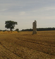 The Menhir de la Hune, in Bazougers | |
show Location of Bazougers | |
 Bazougers | |
| Coordinates: 48°01′02″N 0°34′47″W / 48.0172°N 0.5797°WCoordinates: 48°01′02″N 0°34′47″W / 48.0172°N 0.5797°W | |
| Country | France |
| Region | Pays de la Loire |
| Department | Mayenne |
| Arrondissement | Château-Gontier |
| Canton | Meslay-du-Maine |
| Government | |
| • Mayor (2020–2026) | Jérôme Landelle |
| Area 1 | 31.72 km2 (12.25 sq mi) |
| Population (Jan. 2018)[1] | 1,100 |
| • Density | 35/km2 (90/sq mi) |
| Time zone | UTC+01:00 (CET) |
| • Summer (DST) | UTC+02:00 (CEST) |
| INSEE/Postal code | 53025 /53170 |
| Elevation | 52–108 m (171–354 ft) (avg. 83 m or 272 ft) |
| 1 French Land Register data, which excludes lakes, ponds, glaciers > 1 km2 (0.386 sq mi or 247 acres) and river estuaries. | |


Bazougers (French pronunciation: [bazuʒe]) is a commune in the Mayenne department in northwestern France.
Population[]
| Year | Pop. | ±% |
|---|---|---|
| 1793 | 1,263 | — |
| 1800 | 1,392 | +10.2% |
| 1806 | 1,264 | −9.2% |
| 1821 | 1,311 | +3.7% |
| 1831 | 1,390 | +6.0% |
| 1836 | 1,401 | +0.8% |
| 1841 | 1,473 | +5.1% |
| 1846 | 1,475 | +0.1% |
| 1851 | 1,457 | −1.2% |
| 1856 | 1,410 | −3.2% |
| 1861 | 1,366 | −3.1% |
| 1866 | 1,306 | −4.4% |
| 1872 | 1,308 | +0.2% |
| 1876 | 1,348 | +3.1% |
| 1881 | 1,212 | −10.1% |
| 1886 | 1,198 | −1.2% |
| 1891 | 1,210 | +1.0% |
| 1896 | 1,196 | −1.2% |
| 1901 | 1,214 | +1.5% |
| 1906 | 1,222 | +0.7% |
| 1911 | 1,157 | −5.3% |
| 1921 | 998 | −13.7% |
| 1926 | 1,016 | +1.8% |
| 1931 | 1,017 | +0.1% |
| 1936 | 1,003 | −1.4% |
| 1946 | 946 | −5.7% |
| 1954 | 908 | −4.0% |
| 1962 | 840 | −7.5% |
| 1968 | 781 | −7.0% |
| 1975 | 743 | −4.9% |
| 1982 | 864 | +16.3% |
| 1990 | 869 | +0.6% |
| 1999 | 933 | +7.4% |
| 2006 | 976 | +4.6% |
| 2009 | 999 | +2.4% |
See also[]
- Communes of Mayenne
References[]
- ^ "Populations légales 2018". INSEE. 28 December 2020.
| Wikimedia Commons has media related to Bazougers. |
| show Communes of the Mayenne department |
|---|
This Mayenne geographical article is a stub. You can help Wikipedia by . |
Categories:
- Communes of Mayenne
- Mayenne geography stubs