Bouchamps-lès-Craon
Bouchamps-lès-Craon | |
|---|---|
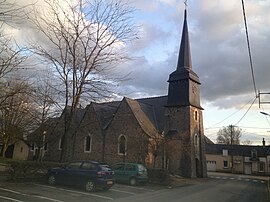 The church in Bouchamps-lès-Craon | |
Location of Bouchamps-lès-Craon  | |
 Bouchamps-lès-Craon | |
| Coordinates: 47°48′56″N 0°59′28″W / 47.8156°N 0.9911°WCoordinates: 47°48′56″N 0°59′28″W / 47.8156°N 0.9911°W | |
| Country | France |
| Region | Pays de la Loire |
| Department | Mayenne |
| Arrondissement | Château-Gontier |
| Canton | Château-Gontier-sur-Mayenne-2 |
| Government | |
| • Mayor (2020–2026) | Jean-Eudes Gaubert |
| Area 1 | 18.15 km2 (7.01 sq mi) |
| Population (Jan. 2018)[1] | 576 |
| • Density | 32/km2 (82/sq mi) |
| Time zone | UTC+01:00 (CET) |
| • Summer (DST) | UTC+02:00 (CEST) |
| INSEE/Postal code | 53035 /53800 |
| Elevation | 31–104 m (102–341 ft) (avg. 106 m or 348 ft) |
| 1 French Land Register data, which excludes lakes, ponds, glaciers > 1 km2 (0.386 sq mi or 247 acres) and river estuaries. | |


Bouchamps-lès-Craon (French pronunciation: [buʃɑ̃ lɛ kʁɑ̃], literally Bouchamps near Craon) is a commune in the Mayenne department in northwestern France.
Geography[]
The river Oudon forms most of the commune's eastern border.
Population[]
| Year | Pop. | ±% |
|---|---|---|
| 1962 | 536 | — |
| 1968 | 525 | −2.1% |
| 1975 | 528 | +0.6% |
| 1982 | 518 | −1.9% |
| 1990 | 507 | −2.1% |
| 1999 | 514 | +1.4% |
| 2006 | 552 | +7.4% |
| 2009 | 566 | +2.5% |
See also[]
- Communes of Mayenne
References[]
- ^ "Populations légales 2018". The National Institute of Statistics and Economic Studies. 28 December 2020.
| Wikimedia Commons has media related to Bouchamps-lès-Craon. |
This Mayenne geographical article is a stub. You can help Wikipedia by . |
Categories:
- Communes of Mayenne
- Mayenne geography stubs