Carelles
Carelles | |
|---|---|
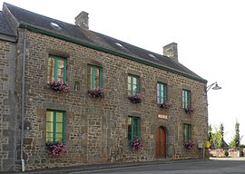 The town hall in Carelles | |
show Location of Carelles | |
 Carelles | |
| Coordinates: 48°23′39″N 0°54′13″W / 48.3942°N 0.9036°WCoordinates: 48°23′39″N 0°54′13″W / 48.3942°N 0.9036°W | |
| Country | France |
| Region | Pays de la Loire |
| Department | Mayenne |
| Arrondissement | Mayenne |
| Canton | Gorron |
| Government | |
| • Mayor (2020–2026) | Gérard Brilhault |
| Area 1 | 13.23 km2 (5.11 sq mi) |
| Population (Jan. 2018)[1] | 269 |
| • Density | 20/km2 (53/sq mi) |
| Time zone | UTC+01:00 (CET) |
| • Summer (DST) | UTC+02:00 (CEST) |
| INSEE/Postal code | 53047 /53120 |
| Elevation | 169–255 m (554–837 ft) (avg. 251 m or 823 ft) |
| 1 French Land Register data, which excludes lakes, ponds, glaciers > 1 km2 (0.386 sq mi or 247 acres) and river estuaries. | |


Carelles (French pronunciation: [kaʁɛl]) is a commune in the Mayenne department in north-western France.
See also[]
- Communes of Mayenne
References[]
- ^ "Populations légales 2018". INSEE. 28 December 2020.
| Wikimedia Commons has media related to Carelles. |
| show Communes of the Mayenne department |
|---|
This Mayenne geographical article is a stub. You can help Wikipedia by . |
Categories:
- Communes of Mayenne
- Mayenne geography stubs