Montsûrs
Montsûrs | |
|---|---|
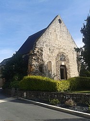 The Chapel of Saint-Martin, in Montsûrs | |
 Coat of arms | |
Location of Montsûrs  | |
 Montsûrs | |
| Coordinates: 48°08′05″N 0°33′09″W / 48.1347°N 0.5525°WCoordinates: 48°08′05″N 0°33′09″W / 48.1347°N 0.5525°W | |
| Country | France |
| Region | Pays de la Loire |
| Department | Mayenne |
| Arrondissement | Mayenne |
| Canton | Évron |
| Area 1 | 68.14 km2 (26.31 sq mi) |
| Population (Jan. 2018)[1] | 3,181 |
| • Density | 47/km2 (120/sq mi) |
| Time zone | UTC+01:00 (CET) |
| • Summer (DST) | UTC+02:00 (CEST) |
| INSEE/Postal code | 53161 /53150 |
| Elevation | 62–151 m (203–495 ft) (avg. 89 m or 292 ft) |
| 1 French Land Register data, which excludes lakes, ponds, glaciers > 1 km2 (0.386 sq mi or 247 acres) and river estuaries. | |


Montsûrs (French pronunciation: [mɔ̃syʁ]) is a commune in the Mayenne department in north-western France. On 1 January 2017, it was merged with Saint-Céneré and formed the short-lived commune Montsûrs-Saint-Céneré.[2] Montsûrs-Saint-Céneré was merged with Deux-Évailles, Montourtier and Saint-Ouën-des-Vallons on 1 January 2019, and the new commune took the name of Montsûrs.[3] The river Jouanne flows through the commune.[4]
Points of interest[]
See also[]
- Communes of the Mayenne department
References[]
- ^ "Populations légales 2018". The National Institute of Statistics and Economic Studies. 28 December 2020.
- ^ Arrêté préfectoral 29 September 2016 (in French)
- ^ Arrêté préfectoral 12 December 2018 (in French)
- ^ Sandre. "Fiche cours d'eau - Jouanne (M34-0300)".
| Wikimedia Commons has media related to Montsûrs. |
This Mayenne geographical article is a stub. You can help Wikipedia by . |
Categories:
- Communes of Mayenne
- Maine (province)
- Mayenne geography stubs