Couptrain
Couptrain | |
|---|---|
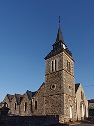 The church of Our Lady of the Assumption, in Couptrain | |
 Coat of arms | |
show Location of Couptrain | |
 Couptrain | |
| Coordinates: 48°29′03″N 0°17′32″W / 48.4842°N 0.2922°WCoordinates: 48°29′03″N 0°17′32″W / 48.4842°N 0.2922°W | |
| Country | France |
| Region | Pays de la Loire |
| Department | Mayenne |
| Arrondissement | Mayenne |
| Canton | Villaines-la-Juhel |
| Government | |
| • Mayor (2020–2026) | Pascal François[1] |
| Area 1 | 0.71 km2 (0.27 sq mi) |
| Population (Jan. 2018)[2] | 132 |
| • Density | 190/km2 (480/sq mi) |
| Time zone | UTC+01:00 (CET) |
| • Summer (DST) | UTC+02:00 (CEST) |
| INSEE/Postal code | 53080 /53250 |
| Elevation | 153–194 m (502–636 ft) (avg. 165 m or 541 ft) |
| 1 French Land Register data, which excludes lakes, ponds, glaciers > 1 km2 (0.386 sq mi or 247 acres) and river estuaries. | |


Couptrain is a commune in the Mayenne department in north-western France.
See also[]
- Communes of the Mayenne department
- Parc naturel régional Normandie-Maine
References[]
- ^ "Répertoire national des élus: les maires". data.gouv.fr, Plateforme ouverte des données publiques françaises (in French). 2 December 2020.
- ^ "Populations légales 2018". INSEE. 28 December 2020.
| Wikimedia Commons has media related to Couptrain. |
| show Communes of the Mayenne department |
|---|
This Mayenne geographical article is a stub. You can help Wikipedia by . |
Categories:
- Communes of Mayenne
- Mayenne geography stubs