Vaiges
Vaiges | |
|---|---|
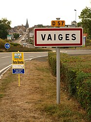 The road into Vaiges | |
show Location of Vaiges | |
 Vaiges | |
| Coordinates: 48°02′29″N 0°28′29″W / 48.0414°N 0.4747°WCoordinates: 48°02′29″N 0°28′29″W / 48.0414°N 0.4747°W | |
| Country | France |
| Region | Pays de la Loire |
| Department | Mayenne |
| Arrondissement | Mayenne |
| Canton | Meslay-du-Maine |
| Government | |
| • Mayor (2020–2026) | Régis Lefeuvre |
| Area 1 | 36.26 km2 (14.00 sq mi) |
| Population (Jan. 2018)[1] | 1,166 |
| • Density | 32/km2 (83/sq mi) |
| Time zone | UTC+01:00 (CET) |
| • Summer (DST) | UTC+02:00 (CEST) |
| INSEE/Postal code | 53267 /53480 |
| Elevation | 67–126 m (220–413 ft) (avg. 91 m or 299 ft) |
| 1 French Land Register data, which excludes lakes, ponds, glaciers > 1 km2 (0.386 sq mi or 247 acres) and river estuaries. | |


Vaiges (French pronunciation: [vɛʒ]) is a commune in the Mayenne department and Pays de la Loire region of France.
Geography[]
The river Vaige forms part of the commune's northern border, then traverses the commune's territory from north to south before forming part of its south-western border.
See also[]
- Communes of the Mayenne department
References[]
- ^ "Populations légales 2018". INSEE. 28 December 2020.
| Wikimedia Commons has media related to Vaiges. |
| show Communes of the Mayenne department |
|---|
This Mayenne geographical article is a stub. You can help Wikipedia by . |
Categories:
- Communes of Mayenne
- Mayenne geography stubs