Mézangers
Mézangers | |
|---|---|
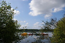 The Gué-de-Selle Lake, in Mézangers | |
show Location of Mézangers | |
 Mézangers | |
| Coordinates: 48°11′30″N 0°25′54″W / 48.1917°N 0.4317°WCoordinates: 48°11′30″N 0°25′54″W / 48.1917°N 0.4317°W | |
| Country | France |
| Region | Pays de la Loire |
| Department | Mayenne |
| Arrondissement | Mayenne |
| Canton | Évron |
| Government | |
| • Mayor (2020–2026) | Robert Geslot |
| Area 1 | 29.34 km2 (11.33 sq mi) |
| Population (Jan. 2018)[1] | 641 |
| • Density | 22/km2 (57/sq mi) |
| Time zone | UTC+01:00 (CET) |
| • Summer (DST) | UTC+02:00 (CEST) |
| INSEE/Postal code | 53153 /53600 |
| Elevation | 84–138 m (276–453 ft) (avg. 108 m or 354 ft) |
| 1 French Land Register data, which excludes lakes, ponds, glaciers > 1 km2 (0.386 sq mi or 247 acres) and river estuaries. | |


Mézangers (French pronunciation: [mezɑ̃ʒe]) is a commune in the Mayenne department in north-western France.[2]
See also[]
- Communes of Mayenne
References[]
- ^ "Populations légales 2018". INSEE. 28 December 2020.
- ^ "MEZANGERS - Map of Mézangers 53600 France". www.map-france.com. Retrieved 25 February 2019.
| Wikimedia Commons has media related to Mézangers. |
| show Communes of the Mayenne department |
|---|
This Mayenne geographical article is a stub. You can help Wikipedia by . |
Categories:
- Communes of Mayenne
- Mayenne geography stubs