Saint-Erblon, Mayenne
Saint-Erblon | |
|---|---|
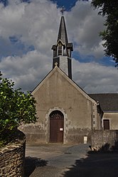 The church in Saint-Erblon | |
show Location of Saint-Erblon | |
 Saint-Erblon | |
| Coordinates: 47°47′17″N 1°09′59″W / 47.7881°N 1.1664°WCoordinates: 47°47′17″N 1°09′59″W / 47.7881°N 1.1664°W | |
| Country | France |
| Region | Pays de la Loire |
| Department | Mayenne |
| Arrondissement | Château-Gontier |
| Canton | Cossé-le-Vivien |
| Intercommunality | Pays de Craon |
| Government | |
| • Mayor (2020–2026) | Olivier Gaucher |
| Area 1 | 5.68 km2 (2.19 sq mi) |
| Population (Jan. 2018)[1] | 169 |
| • Density | 30/km2 (77/sq mi) |
| Time zone | UTC+01:00 (CET) |
| • Summer (DST) | UTC+02:00 (CEST) |
| INSEE/Postal code | 53214 /53390 |
| Elevation | 65–106 m (213–348 ft) (avg. 101 m or 331 ft) |
| 1 French Land Register data, which excludes lakes, ponds, glaciers > 1 km2 (0.386 sq mi or 247 acres) and river estuaries. | |


Saint-Erblon (French pronunciation: [sɛ̃.t‿ɛʁblɔ̃]) is a commune in the Mayenne department in north-western France.
Geography[]
The Semnon forms all of the commune's northern border.
See also[]
- Communes of the Mayenne department
References[]
- ^ "Populations légales 2018". INSEE. 28 December 2020.
| Wikimedia Commons has media related to Saint-Erblon (Mayenne). |
| show Communes of the Mayenne department |
|---|
This Mayenne geographical article is a stub. You can help Wikipedia by . |
Categories:
- Communes of Mayenne
- Mayenne geography stubs