Angliers, Charente-Maritime
Angliers | |
|---|---|
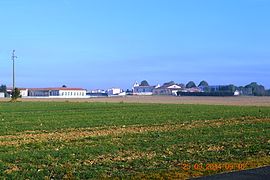 A general view of Angliers | |
 Coat of arms | |
show Location of Angliers | |
 Angliers | |
| Coordinates: 46°12′46″N 0°56′55″W / 46.2128°N 0.9486°WCoordinates: 46°12′46″N 0°56′55″W / 46.2128°N 0.9486°W | |
| Country | France |
| Region | Nouvelle-Aquitaine |
| Department | Charente-Maritime |
| Arrondissement | La Rochelle |
| Canton | Marans |
| Intercommunality | |
| Government | |
| • Mayor (2020–2026) | Didier Taupin[1] |
| Area 1 | 10.74 km2 (4.15 sq mi) |
| Population (Jan. 2018)[2] | 1,096 |
| • Density | 100/km2 (260/sq mi) |
| Time zone | UTC+01:00 (CET) |
| • Summer (DST) | UTC+02:00 (CEST) |
| INSEE/Postal code | 17009 /17540 |
| Elevation | 1–19 m (3.3–62.3 ft) (avg. 6 m or 20 ft) |
| 1 French Land Register data, which excludes lakes, ponds, glaciers > 1 km2 (0.386 sq mi or 247 acres) and river estuaries. | |


Angliers (French pronunciation: [ɑ̃ɡlije]) is a commune in the Charente-Maritime department in the Nouvelle-Aquitaine region of south-western France.
The inhabitants of the commune are known as Anglésiens or Anglésiennes.[3]
Geography[]

Angliers is located some 15 km north-east of La Rochelle and 15 km south by south-east of Marans. National highway N11 (E601) passes through the north of the commune and there is an exit at the north-eastern tip of the commune to the D109 road which runs south through the commune to Vérines. Access to the village is by a country road off the D109. There is also the D203E1 road running from the hamlet of Saint-Gilles west to Loiré. Apart from the village, there are also the hamlets of Le Grand Peu, Saint-Gilles, and Les Loges. The commune is entirely farmland.[4]
Angliers commune is divided into two clearly distinct parts:
- To the west, the commune is a part of the plain of Aunis and is characterized by rolling limestone hills.
- To the east is a marsh which is part of the Marais Poitevin.
The swamp is drained by the waters of the Curé river which is a small coastal river and serves as the eastern boundary of the commune. This river has its source in the commune of Saint-Georges-du-Bois and becomes a Canal before emptying into the Bay of Aiguillon. It is called the Canal du Curé at Angliers. Formerly, the eastern part of Angliers was always flooded along the road north of the commune that joins the village of Le Grand Peu to Nuaillé-d'Aunis. Angliers is at the southern limit of the Marais Poitevin.
Transport[]
- Railway Stations and Halts
- La Rochelle (TGV) 16.2 km
- Aytré (Halt) 16.4 km
- Mer 16.7 km
- Châtelaillon 18.2 km
- Surgères (TGV) 18.4 km
- Airports and aerodromes
- La Rochelle – Île de Ré Airport 18.9 km
- Rochefort - Saint-Agnant Airport 36.1 km
- Niort 43.9 km
Neighbouring communes and villages[]
| show Places adjacent to Angliers, Charente-Maritime |
|---|
History[]
The history of Angliers before Gallo-Roman times has been lost, as with many neighbouring communes. However, a few important remains have been found. Sarcophagi found in the 19th century at Gillebergère are not necessarily from those remote times. Ancient relics are rare but the door of the church dates from 1100/1130. It once came under the Abbey of Nieul-sur-l'Autise. This church has undergone many changes throughout its history mainly because of the Hundred Years War and the Wars of Religion. The fighting that took place around the castles of Benon, Nuaillé-d'Aunis, and Surgères suggest many passages by the Port Bertrand through the east of Angliers to the town of La Rochelle.
Administration[]

This list is incomplete; you can help by . (April 2021) |
List of Successive Mayors[5]
| From | To | Name | Party | Position |
|---|---|---|---|---|
| 2001 | 2026 | Didier Taupin | PS | Sports Instructor |
Population[]
| Year | Pop. | ±% |
|---|---|---|
| 2006 | 664 | — |
| 2007 | 707 | +6.5% |
| 2008 | 784 | +10.9% |
| 2009 | 782 | −0.3% |
| 2010 | 802 | +2.6% |
| 2011 | 823 | +2.6% |
| 2012 | 843 | +2.4% |
| 2013 | 888 | +5.3% |
| 2014 | 967 | +8.9% |
| 2015 | 998 | +3.2% |
| 2016 | 1,029 | +3.1% |

Distribution of Age Groups[]
The population of the town is much younger than the departmental average.
Percentage Distribution of Age Groups in Angliers and Charente-Maritime Department in 2017
| Angliers | Charente-Maritime | |||
|---|---|---|---|---|
| Age Range | Men | Women | Men | Women |
| 0 to 14 Years | 27.7 | 27.2 | 16.3 | 14.3 |
| 15 to 29 Years | 14.8 | 14.4 | 15.4 | 13.1 |
| 30 to 44 Years | 29.6 | 29.5 | 16.7 | 16.1 |
| 45 to 59 Years | 17.8 | 17.1 | 20.2 | 19.9 |
| 60 to 74 Years | 8.9 | 8.8 | 21.1 | 22.0 |
| 75 to 89 Years | 1.1 | 2.1 | 9.4 | 12.3 |
| 90 Years+ | 0.0 | 0.9 | 1.0 | 2.4 |
Culture and heritage[]

Civil heritage[]
The commune has a number of buildings and structures that are registered as historical monuments:
- The Logis de Ré Manor (17th century)
 [8]
[8] - The Chateau de Ré Manor (18th century)[9]
- A Farmhouse at Saint-Eloi (1903)[10]
- A House at Le Peu (19th century)[11]
- A Farmhouse at Mouche de Ne (1773)[12]
- A House at Les Loges (1866)[13]
- A Mill at Moulin-Gelot (19th century)[14]
- Houses and Farms[15]
Religious heritage[]


The commune has several religious buildings and structures that are registered as historical monuments:
- A Cemetery Cross (17th century)[16]
- The Priory of Saint Peter (12th century).[17] The Priory contains many items that are registered as historical objects:
- A Baptismal font (1651)
 [18]
[18] - A Stained glass window: Saint Bernadette (20th century)[19]
- 3 Stained glass windows: Sacred heart of Jesus, Virgin and child, and Saint Peter (1901)[20]
- A Bronze Bell (1641)[21]
- A Chalice (19th century)[22]
- A Pail for holy water (19th century)[23]
- A Chalice (19th century)[22]
- A Thurible (18th century)[24]
- A Painting: Saint Peter (19th century)[25]
- 2 Statues: Saint Joseph with the child Jesus and Saint Theresa of Lisieux (20th century)[26]
- A Prie-dieu (19th century)[27]
- A Stoup (17th century)[28]
- A Baptismal font (1651)[29]
- An Altar and Tabernacle (19th century)[30]
- A Stained glass window: The Theological virtues (19th century)[31]
- A Baptismal font (1651)
See also[]
External links[]
- Tourism for the Canton de Courçon official website
- Angliers on the National Geographic Institute website[permanent dead link] (in French)
- Angliers on Lion1906
- Angliers on Géoportail, National Geographic Institute (IGN) website (in French)
- Angliers on the 1750 Cassini Map
References[]
- ^ "Répertoire national des élus: les maires". data.gouv.fr, Plateforme ouverte des données publiques françaises (in French). 2 December 2020. Retrieved 7 December 2020.
- ^ "Populations légales 2018". INSEE. 28 December 2020.
- ^ Inhabitants of Charente-Maritime (in French)
- ^ Jump up to: a b Google Maps
- ^ List of Mayors of France
- ^ Évolution et structure de la population en 2017: Commune d'Angliers (17009)
- ^ Évolution et structure de la population en 2017: Département de la Charente-Maritime (17)
- ^ Ministry of Culture, Mérimée IA00043350 Logis de Ré Manor (in French)
- ^ Ministry of Culture, Mérimée IA00043351 Chateau de Ré Manor (in French)
- ^ Ministry of Culture, Mérimée IA00043352 Farmhouse at Saint-Eloi (in French)
- ^ Ministry of Culture, Mérimée IA00043349 House at Le Peu (in French)
- ^ Ministry of Culture, Mérimée IA00043348 Farmhouse at Mouche de Ne (in French)
- ^ Ministry of Culture, Mérimée IA00043347 House at Les Loges (in French)
- ^ Ministry of Culture, Mérimée IA00043346 Mill at Moulin-Gelot (in French)
- ^ Ministry of Culture, Mérimée IA00043344 Houses and Farms (in French)
- ^ Ministry of Culture, Mérimée IA00043353 Cemetery Cross (in French)
- ^ Ministry of Culture, Mérimée IA00043345 Priory of Saint Peter (in French)

- ^ Ministry of Culture, Palissy PM17000009 Baptismal font (in French)
- ^ Ministry of Culture, Palissy IM17003246 Stained glass window: Saint Bernadette (in French)
- ^ Ministry of Culture, Palissy IM17003245 3 Stained glass windows: Sacred heart of Jesus, Virgin and child, and Saint Peter (in French)
- ^ Ministry of Culture, Palissy IM17003198 Bronze bell (in French)
- ^ Jump up to: a b Ministry of Culture, Palissy IM17003197 Chalice (in French)
- ^ Ministry of Culture, Palissy IM17003196 Pail for holy water (in French)
- ^ Ministry of Culture, Palissy IM17003195 Thurible (in French)
- ^ Ministry of Culture, Palissy IM17003194 Painting: Saint Peter (in French)
- ^ Ministry of Culture, Palissy IM17003193 2 Statues: Saint Joseph with the child Jesus and Saint Theresa of Lisieux (in French)
- ^ Ministry of Culture, Palissy IM17003192 Prie-dieu (in French)
- ^ Ministry of Culture, Palissy IM17003191 Stoup (in French)
- ^ Ministry of Culture, Palissy IM17003190 Baptismal font (in French)
- ^ Ministry of Culture, Palissy IM17003189 Altar and Tabernacle (in French)
- ^ Ministry of Culture, Palissy IM17003188 Stained glass window: The Theological virtues (in French)
| Wikimedia Commons has media related to Angliers (Charente-Maritime). |
- Communes of Charente-Maritime