Anos, Pyrénées-Atlantiques
Anos | |
|---|---|
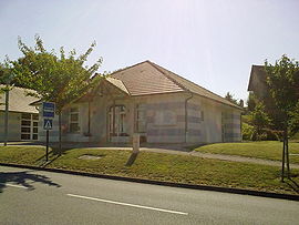 Town hall | |
show Location of Anos | |
 Anos | |
| Coordinates: 43°23′57″N 0°17′29″W / 43.3992°N 0.2914°WCoordinates: 43°23′57″N 0°17′29″W / 43.3992°N 0.2914°W | |
| Country | France |
| Region | Nouvelle-Aquitaine |
| Department | Pyrénées-Atlantiques |
| Arrondissement | Pau |
| Canton | Pays de Morlaàs et du Montanérès |
| Intercommunality | Nord Est Béarn |
| Government | |
| • Mayor (2020–2026) | Christelle Desclaux[1] |
| Area 1 | 1.79 km2 (0.69 sq mi) |
| Population (Jan. 2018)[2] | 190 |
| • Density | 110/km2 (270/sq mi) |
| Time zone | UTC+01:00 (CET) |
| • Summer (DST) | UTC+02:00 (CEST) |
| INSEE/Postal code | 64027 /64160 |
| Elevation | 199–305 m (653–1,001 ft) (avg. 250 m or 820 ft) |
| 1 French Land Register data, which excludes lakes, ponds, glaciers > 1 km2 (0.386 sq mi or 247 acres) and river estuaries. | |


Anos is a commune in the Pyrénées-Atlantiques department in the Nouvelle-Aquitaine region of southwestern France. It is part of the urban area (aire d'attraction des villes) of Pau.[3]
The inhabitants of the commune are known as Anosiens or Anosiennes[4]


Geography[]
Anos is located some 15 km north-east of Pau and 10 km south-east of Auriac. Access to the commune is by road D39 from Morlaas in the south passing north through the commune and the village and continuing north to join the D834 just north of Astis. Several other country roads also pass through the commune.
The Lau river forms the western border of the commune with the eastern shore of the Lake of Saint-Amour (also called the Lake of Anos) forming the part just west of the village. The Lau flows north to join the Luy de France which also forms the eastern border of the commune.[5]
Historical Localities and hamlets[]
- Guilhem
- Guillaumet
- Guiraut
- Jouannes
- Lartigue
- Peyré
- Peys
- Puyau
- Tachoères[6]
Toponymy[]
The commune name in Béarnais is Anòs (according to the classical norm of Occitan).
Brigitte Jobbé-Duval[9] indicates that Anos could be of Gallic origin being the name of the property owner Andus plus the suffix -ossu with a proposed meaning of "Domain of Andus".
The name Anos was mentioned in 1243[10] in the Titles of Ossau[11] and in the Cassini map in 1750[12]).
History[]
Paul Raymond[10] noted on page 6 of the 1863 dictionary that in the 14th century Anos belonged to the community of Preachers of Morlaàs.
The commune was part of the archdeaconry of Vic-Bihl which depended on the diocese of Lescar of which Lembeye was the capital.[10]
Administration[]
This list is incomplete; you can help by . (April 2021) |
List of Successive Mayors[13]
| From | To | Name |
|---|---|---|
| 1995 | 2008 | Jacques Cantonnet |
| 2008 | 2014 | Patrick Yacger |
| 2014 | 2026 | Christelle Desclaux |
Inter-communality[]
Anos is part of five inter-communal structures:[14]
- The Communauté de communes du Nord-Est Béarn;
- The SIVU for the maintenance of roads, parks and buildings in Barinque;
- The AEP association for the Regions of Luy and Gabas;
- The Energy association of Pyrénées-Atlantiques;
- The iner-communal association for irrigation of Anos - Saint-Armou.
Demography[]
In 2017 the commune had 192 inhabitants.
|
|
| ||||||||||||||||||||||||||||||||||||||||||||||||||||||||||||||||||||||||||||||||||||||||||||||||||||||||||||||||||
| Source: EHESS[15] and INSEE (1968-2017)[16] | ||||||||||||||||||||||||||||||||||||||||||||||||||||||||||||||||||||||||||||||||||||||||||||||||||||||||||||||||||||
Culture and Heritage[]
Civil heritage[]
- The Maison Tachoères farmhouse (1768)
 is registered as an historical monument.[6]
 - Other Houses and Farms (18th-19th century) are also registered as historical monuments.[17]
Religious heritage[]
- The Parish Church of Saint-Laurent (11th century) is registered as an historical monument.[18]
Environmental heritage[]
An artificial lake called Lake Saint-Armou or Lake of Anos[8] is on the border between the two communes.
See also[]
References[]
- ^ "Répertoire national des élus: les maires". data.gouv.fr, Plateforme ouverte des données publiques françaises (in French). 2 December 2020.
- ^ "Populations légales 2018". INSEE. 28 December 2020.
- ^ Commune d'Anos (64027), INSEE
- ^ Inhabitants of Pyrénées-Atlantiques (in French)
- ^ Google Maps
- ^ Jump up to: a b Ministry of Culture, Mérimée IA00026891 Maison Tachoères farmhouse (in French)
- ^ Michel Grosclaude, Toponymic Dictionary of communes, Béarn, Edicions reclams & Édition Cairn, 2006, ISBN 2 35068 005 3 (in French)
- ^ Jump up to: a b Géoportail, IGN, consulted on 25 November 2011 (in French)
- ^ Brigitte Jobbé-Duval, Dictionary of Place Names - Pyrénées-Atlantiques, 2009, Archives and Culture, ISBN 978-2-35077-151-9 (in French)
- ^ Jump up to: a b c Topographic Dictionary of the Department of Basses-Pyrenees, Paul Raymond, Imprimerie nationale, 1863, Digitised from Lyon Public Library 15 June 2011 (in French)
- ^ Titles of the Ossau Valley - Departmental archives of Pyrénées-Atlantiques
- ^ Cassini Map 1750 - Anos
- ^ List of Mayors of France
- ^ Intercommunality of Pyrénées-Atlantiques, Cellule informatique préfecture 64, consulted on 25 November 2011 (in French)
- ^ Des villages de Cassini aux communes d'aujourd'hui: Commune data sheet Anos, EHESS. (in French)
- ^ Population en historique depuis 1968, INSEE
- ^ Ministry of Culture, Mérimée IA00026890 Houses and Farms (in French)
- ^ Ministry of Culture, Mérimée IA00026892 Parish Church of Saint-Laurent (in French)
| Wikimedia Commons has media related to Anos. |
External links[]
- Anos on Lion1906
- Anos on Géoportail, National Geographic Institute (IGN) website (in French)
- Anos on the 1750 Cassini Map
| show Places adjacent to Anos, Pyrénées-Atlantiques |
|---|
- Communes of Pyrénées-Atlantiques