Montardon
Montardon | |
|---|---|
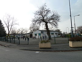 The school of Montardon | |
show Location of Montardon | |
 Montardon | |
| Coordinates: 43°22′36″N 0°20′22″W / 43.3767°N 0.3394°WCoordinates: 43°22′36″N 0°20′22″W / 43.3767°N 0.3394°W | |
| Country | France |
| Region | Nouvelle-Aquitaine |
| Department | Pyrénées-Atlantiques |
| Arrondissement | Pau |
| Canton | Terres des Luys et Coteaux du Vic-Bilh |
| Intercommunality | Luys en Béarn |
| Government | |
| • Mayor (2020–2026) | Stéphane Bonnasiolle |
| Area 1 | 8.42 km2 (3.25 sq mi) |
| Population (Jan. 2018)[1] | 2,305 |
| • Density | 270/km2 (710/sq mi) |
| Time zone | UTC+01:00 (CET) |
| • Summer (DST) | UTC+02:00 (CEST) |
| INSEE/Postal code | 64399 /64121 |
| Elevation | 194–295 m (636–968 ft) (avg. 219 m or 719 ft) |
| 1 French Land Register data, which excludes lakes, ponds, glaciers > 1 km2 (0.386 sq mi or 247 acres) and river estuaries. | |


show This article may be expanded with text translated from the corresponding article in French. (December 2008) Click [show] for important translation instructions. |
Montardon (French pronunciation: [mɔ̃taʁdɔ̃]) is a commune in the Pyrénées-Atlantiques department in south-western France.
Montardon offers several activities : a tennis and a basketball playgrounds. The closest swimming pool is the one of Serres-Castet.
See also[]
References[]
- ^ "Populations légales 2018". INSEE. 28 December 2020.
| Wikimedia Commons has media related to Montardon. |
This Pyrénées-Atlantiques geographical article is a stub. You can help Wikipedia by . |
Categories:
- Communes of Pyrénées-Atlantiques
- Pyrénées-Atlantiques geography stubs