Cette-Eygun
Cette-Eygun | |
|---|---|
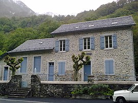 Town Hall of Cette-Eygun | |
show Location of Cette-Eygun | |
 Cette-Eygun | |
| Coordinates: 42°56′15″N 0°35′17″W / 42.9375°N 0.5881°WCoordinates: 42°56′15″N 0°35′17″W / 42.9375°N 0.5881°W | |
| Country | France |
| Region | Nouvelle-Aquitaine |
| Department | Pyrénées-Atlantiques |
| Arrondissement | Oloron-Sainte-Marie |
| Canton | Oloron-Sainte-Marie-1 |
| Intercommunality | Haut Béarn |
| Government | |
| • Mayor (2008–2014) | Jean Gastou |
| Area 1 | 18.97 km2 (7.32 sq mi) |
| Population (Jan. 2018)[1] | 64 |
| • Density | 3.4/km2 (8.7/sq mi) |
| Time zone | UTC+01:00 (CET) |
| • Summer (DST) | UTC+02:00 (CEST) |
| INSEE/Postal code | 64185 /64490 |
| Elevation | 501–2,560 m (1,644–8,399 ft) |
| 1 French Land Register data, which excludes lakes, ponds, glaciers > 1 km2 (0.386 sq mi or 247 acres) and river estuaries. | |


show This article may be expanded with text translated from the corresponding article in French. (December 2008) Click [show] for important translation instructions. |
Cette-Eygun is a commune in the Pyrénées-Atlantiques department in south-western France.
Its station on the Pau–Canfranc railway was closed after an accident in 1970.
See also[]
References[]
- ^ "Populations légales 2018". INSEE. 28 December 2020.
| Wikimedia Commons has media related to Cette-Eygun. |
This Pyrénées-Atlantiques geographical article is a stub. You can help Wikipedia by . |
Categories:
- Communes of Pyrénées-Atlantiques
- Pyrénées-Atlantiques geography stubs