Méracq
Méracq | |
|---|---|
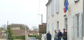 The town hall of Méracq | |
show Location of Méracq | |
 Méracq | |
| Coordinates: 43°30′32″N 0°23′10″W / 43.509°N 0.386°WCoordinates: 43°30′32″N 0°23′10″W / 43.509°N 0.386°W | |
| Country | France |
| Region | Nouvelle-Aquitaine |
| Department | Pyrénées-Atlantiques |
| Arrondissement | Pau |
| Canton | Artix et Pays de Soubestre |
| Intercommunality | Luys en Béarn |
| Government | |
| • Mayor (2020–2026) | Pierre Duplantier[1] |
| Area 1 | 8.24 km2 (3.18 sq mi) |
| Population (Jan. 2018)[2] | 229 |
| • Density | 28/km2 (72/sq mi) |
| Time zone | UTC+01:00 (CET) |
| • Summer (DST) | UTC+02:00 (CEST) |
| INSEE/Postal code | 64380 /64410 |
| Elevation | 109–245 m (358–804 ft) (avg. 197 m or 646 ft) |
| 1 French Land Register data, which excludes lakes, ponds, glaciers > 1 km2 (0.386 sq mi or 247 acres) and river estuaries. | |


show This article may be expanded with text translated from the corresponding article in French. (December 2008) Click [show] for important translation instructions. |
Méracq (French pronunciation: [meʁak]; Occitan: Lo Merac) is a commune in the Pyrénées-Atlantiques département in south-western France.
Name[]
Historically, Méracq has been recorded as Meirac (13th century), Honerac (1538), Lo Merac (1546) and Louméracq (1863).[3]
Its name in Gascon is Lou Mérac.[4]
See also[]
References[]
- ^ "Répertoire national des élus: les maires". data.gouv.fr, Plateforme ouverte des données publiques françaises (in French). 2 December 2020.
- ^ "Populations légales 2018". INSEE. 28 December 2020.
- ^ Paul Raymond, Dictionnaire topographique Béarn-Pays basque
- ^ "Archived copy". Archived from the original on 2014-05-25. Retrieved 2014-05-25.CS1 maint: archived copy as title (link)
| Wikimedia Commons has media related to Méracq. |
This Pyrénées-Atlantiques geographical article is a stub. You can help Wikipedia by . |
Categories:
- Communes of Pyrénées-Atlantiques
- Pyrénées-Atlantiques geography stubs