Loubieng
Loubieng | |
|---|---|
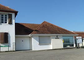 The town hall of Loubieng | |
show Location of Loubieng | |
 Loubieng | |
| Coordinates: 43°25′57″N 0°45′27″W / 43.4325°N 0.7575°WCoordinates: 43°25′57″N 0°45′27″W / 43.4325°N 0.7575°W | |
| Country | France |
| Region | Nouvelle-Aquitaine |
| Department | Pyrénées-Atlantiques |
| Arrondissement | Pau |
| Canton | Le Cœur de Béarn |
| Intercommunality | Lacq-Orthez |
| Government | |
| • Mayor (2020–2026) | Francis Larroque |
| Area 1 | 23.43 km2 (9.05 sq mi) |
| Population (Jan. 2018)[1] | 510 |
| • Density | 22/km2 (56/sq mi) |
| Time zone | UTC+01:00 (CET) |
| • Summer (DST) | UTC+02:00 (CEST) |
| INSEE/Postal code | 64349 /64300 |
| Elevation | 73–224 m (240–735 ft) (avg. 100 m or 330 ft) |
| 1 French Land Register data, which excludes lakes, ponds, glaciers > 1 km2 (0.386 sq mi or 247 acres) and river estuaries. | |


show This article may be expanded with text translated from the corresponding article in French. (December 2008) Click [show] for important translation instructions. |
Loubieng (French pronunciation: [lubjɛ̃]; Occitan: Lobienh) is a commune in the Pyrénées-Atlantiques department in south-western France.
See also[]
References[]
- ^ "Populations légales 2018". INSEE. 28 December 2020.
| Wikimedia Commons has media related to Loubieng. |
This Pyrénées-Atlantiques geographical article is a stub. You can help Wikipedia by . |
Categories:
- Communes of Pyrénées-Atlantiques
- Pyrénées-Atlantiques geography stubs