Dognen
Dognen | |
|---|---|
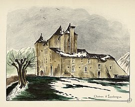 The château of Espalungue | |
show Location of Dognen | |
 Dognen | |
| Coordinates: 43°17′34″N 0°44′22″W / 43.2928°N 0.7394°WCoordinates: 43°17′34″N 0°44′22″W / 43.2928°N 0.7394°W | |
| Country | France |
| Region | Nouvelle-Aquitaine |
| Department | Pyrénées-Atlantiques |
| Arrondissement | Oloron-Sainte-Marie |
| Canton | Le Cœur de Béarn |
| Intercommunality | Béarn des Gaves |
| Government | |
| • Mayor (2020–2026) | Patrick Gourriet |
| Area 1 | 6.79 km2 (2.62 sq mi) |
| Population (Jan. 2018)[1] | 224 |
| • Density | 33/km2 (85/sq mi) |
| Time zone | UTC+01:00 (CET) |
| • Summer (DST) | UTC+02:00 (CEST) |
| INSEE/Postal code | 64201 /64190 |
| Elevation | 120–223 m (394–732 ft) (avg. 148 m or 486 ft) |
| 1 French Land Register data, which excludes lakes, ponds, glaciers > 1 km2 (0.386 sq mi or 247 acres) and river estuaries. | |


show This article may be expanded with text translated from the corresponding article in French. (December 2008) Click [show] for important translation instructions. |
Dognen (French pronunciation: [dɔɲɛ̃]; Occitan: Dònhen) is a commune in the Pyrénées-Atlantiques department in south-western France.
See also[]
References[]
- ^ "Populations légales 2018". INSEE. 28 December 2020.
| Wikimedia Commons has media related to Dognen. |
This Pyrénées-Atlantiques geographical article is a stub. You can help Wikipedia by . |
Categories:
- Communes of Pyrénées-Atlantiques
- Pyrénées-Atlantiques geography stubs