Puyoô
Puyoô | |
|---|---|
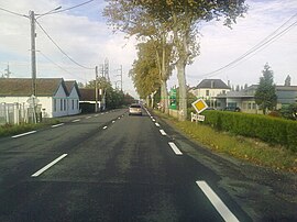 The road into Puyoô | |
show Location of Puyoô | |
 Puyoô | |
| Coordinates: 43°31′N 0°55′W / 43.52°N 0.91°WCoordinates: 43°31′N 0°55′W / 43.52°N 0.91°W | |
| Country | France |
| Region | Nouvelle-Aquitaine |
| Department | Pyrénées-Atlantiques |
| Arrondissement | Pau |
| Canton | Orthez et Terres des Gaves et du Sel |
| Government | |
| • Mayor (2020–2026) | Michel Labourdette |
| Area 1 | 9.32 km2 (3.60 sq mi) |
| Population (Jan. 2018)[1] | 1,132 |
| • Density | 120/km2 (310/sq mi) |
| Time zone | UTC+01:00 (CET) |
| • Summer (DST) | UTC+02:00 (CEST) |
| INSEE/Postal code | 64461 /64270 |
| Elevation | 17–155 m (56–509 ft) (avg. 41 m or 135 ft) |
| 1 French Land Register data, which excludes lakes, ponds, glaciers > 1 km2 (0.386 sq mi or 247 acres) and river estuaries. | |


Puyoô (French pronunciation: [pɥijo]) is a commune in the Pyrénées-Atlantiques department in south-western France.
Geography[]
The town is situated on the Gave de Pau, a river running through the region, and some of the river's tributaries, including the streams of Lataillard, Espérance and Loulié. Puyoô neighbours the towns of Bellocq to the south-west and Ramous to the south-east.
Name[]
Puyoô is derived from the Bearnaise word Pujóu meaning small hill. Pujóu can be further derived from the Latin word podium, meaning height.[2] People from the town are known in French as Puyolais.
Economy[]
The town's economy is generally agriculture-oriented.
Transport[]
The local railway station, Gare de Puyoô, opened in 1862. Today,[when?] it has approximately 10,300 passengers a year.
Culture[]
Puyoô has a rugby field and tennis courts, as well as a town hall. A community festival is held towards the end of June.
See also[]
References[]
- ^ "Populations légales 2018". INSEE. 28 December 2020.
- ^ Paul Raymond, Dictionnaire topographique Béarn-Pays basque. (Topographical Dictionary of Basque in the Béarn Region.)
External links[]
| Wikimedia Commons has media related to Puyoô. |
- Main website (in French)
This Pyrénées-Atlantiques geographical article is a stub. You can help Wikipedia by . |
- Communes of Pyrénées-Atlantiques
- Pyrénées-Atlantiques geography stubs