Armes, Nièvre
Armes | |
|---|---|
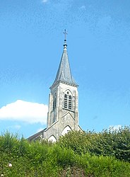 The church in Armes | |
 Coat of arms | |
show Location of Armes | |
 Armes | |
| Coordinates: 47°27′34″N 3°32′55″E / 47.4594°N 3.5486°ECoordinates: 47°27′34″N 3°32′55″E / 47.4594°N 3.5486°E | |
| Country | France |
| Region | Bourgogne-Franche-Comté |
| Department | Nièvre |
| Arrondissement | Clamecy |
| Canton | Clamecy |
| Intercommunality | |
| Government | |
| • Mayor (2020–2026) | Françoise Wittmer[1] |
| Area 1 | 8.49 km2 (3.28 sq mi) |
| Population (Jan. 2018)[2] | 283 |
| • Density | 33/km2 (86/sq mi) |
| Time zone | UTC+01:00 (CET) |
| • Summer (DST) | UTC+02:00 (CEST) |
| INSEE/Postal code | 58011 /58500 |
| Elevation | 147–252 m (482–827 ft) |
| 1 French Land Register data, which excludes lakes, ponds, glaciers > 1 km2 (0.386 sq mi or 247 acres) and river estuaries. | |


Armes is a commune in the Nièvre department in central France.
Population[]
| Year | Pop. | ±% |
|---|---|---|
| 1962 | 299 | — |
| 1968 | 307 | +2.7% |
| 1975 | 325 | +5.9% |
| 1982 | 293 | −9.8% |
| 1990 | 244 | −16.7% |
| 1999 | 279 | +14.3% |
| 2006 | 287 | +2.9% |
| 2007 | 288 | +0.3% |
| 2009 | 281 | −2.4% |
| 2015 | 298 | +6.0% |
See also[]
References[]
- ^ "Répertoire national des élus: les maires". data.gouv.fr, Plateforme ouverte des données publiques françaises (in French). 2 December 2020.
- ^ "Populations légales 2018". INSEE. 28 December 2020.
| Wikimedia Commons has media related to Armes, Nièvre. |
This Nièvre geographical article is a stub. You can help Wikipedia by . |
Categories:
- Communes of Nièvre
- Nièvre geography stubs