Mhère
Mhère | |
|---|---|
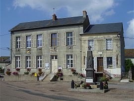 The town hall in Mhère | |
show Location of Mhère | |
 Mhère | |
| Coordinates: 47°12′29″N 3°51′24″E / 47.2081°N 3.8567°ECoordinates: 47°12′29″N 3°51′24″E / 47.2081°N 3.8567°E | |
| Country | France |
| Region | Bourgogne-Franche-Comté |
| Department | Nièvre |
| Arrondissement | Clamecy |
| Canton | Corbigny |
| Intercommunality | Tannay-Brinon-Corbigny |
| Government | |
| • Mayor (2020–2026) | Cyril Trinquet[1] |
| Area 1 | 25.25 km2 (9.75 sq mi) |
| Population (Jan. 2018)[2] | 231 |
| • Density | 9.1/km2 (24/sq mi) |
| Time zone | UTC+01:00 (CET) |
| • Summer (DST) | UTC+02:00 (CEST) |
| INSEE/Postal code | 58166 /58140 |
| Elevation | 255–550 m (837–1,804 ft) |
| 1 French Land Register data, which excludes lakes, ponds, glaciers > 1 km2 (0.386 sq mi or 247 acres) and river estuaries. | |


Mhère is a commune in the Nièvre department in central France.
According to the Institut Géographique National, between 1 January 2007 and 1 January 2008, Mhère was the geographic centre of the Eurozone, after its enlargement to Slovenia.[3] With the admission of Cyprus and Malta, this centre was moved to Ouroux-en-Morvan.
Demographics[]
At the 1999 census, the population was 279. On 1 January 2004, the estimate was 291.
See also[]
References[]
Notes[]
- ^ "Répertoire national des élus: les maires". data.gouv.fr, Plateforme ouverte des données publiques françaises (in French). 2 December 2020. Retrieved 7 December 2020.
- ^ "Populations légales 2018". INSEE. 28 December 2020.
- ^ Centre de l’Euroland, IGN Archived 2007-10-31 at the Wayback Machine
| Wikimedia Commons has media related to Mhère. |
This Nièvre geographical article is a stub. You can help Wikipedia by . |
Categories:
- Communes of Nièvre
- Nièvre geography stubs