Champvert
Champvert | |
|---|---|
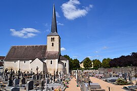 The church in Champvert | |
show Location of Champvert | |
 Champvert | |
| Coordinates: 46°50′28″N 3°30′43″E / 46.8411°N 3.5119°ECoordinates: 46°50′28″N 3°30′43″E / 46.8411°N 3.5119°E | |
| Country | France |
| Region | Bourgogne-Franche-Comté |
| Department | Nièvre |
| Arrondissement | Nevers |
| Canton | Decize |
| Intercommunality | Sud Nivernais |
| Government | |
| • Mayor (2020–2026) | Daniel Caillot[1] |
| Area 1 | 46.12 km2 (17.81 sq mi) |
| Population (Jan. 2018)[2] | 779 |
| • Density | 17/km2 (44/sq mi) |
| Time zone | UTC+01:00 (CET) |
| • Summer (DST) | UTC+02:00 (CEST) |
| INSEE/Postal code | 58055 /58300 |
| Elevation | 187–282 m (614–925 ft) |
| 1 French Land Register data, which excludes lakes, ponds, glaciers > 1 km2 (0.386 sq mi or 247 acres) and river estuaries. | |


Champvert (French pronunciation: [ʃɑ̃vɛʁ]) is a commune in the Nièvre department in central France.
Demographics[]
At the 1999 census, the population was 851. On 1 January 2017, the estimate was 797.
See also[]
References[]
- ^ Maires au 17-06-2020, data.gouv.fr, accessed 7 December 2020
- ^ "Populations légales 2018". INSEE. 28 December 2020.
| Wikimedia Commons has media related to Champvert. |
This Nièvre geographical article is a stub. You can help Wikipedia by . |
Categories:
- Communes of Nièvre
- Nièvre geography stubs