Chazeuil, Nièvre
Chazeuil | |
|---|---|
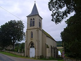 The church in Chazeuil | |
show Location of Chazeuil | |
 Chazeuil | |
| Coordinates: 47°16′38″N 3°24′09″E / 47.2772°N 3.40250°ECoordinates: 47°16′38″N 3°24′09″E / 47.2772°N 3.40250°E | |
| Country | France |
| Region | Bourgogne-Franche-Comté |
| Department | Nièvre |
| Arrondissement | Clamecy |
| Canton | Corbigny |
| Intercommunality | Tannay-Brinon-Corbigny |
| Government | |
| • Mayor (2020–2026) | Armelle Hameau |
| Area 1 | 4.61 km2 (1.78 sq mi) |
| Population (Jan. 2018)[1] | 58 |
| • Density | 13/km2 (33/sq mi) |
| Time zone | UTC+01:00 (CET) |
| • Summer (DST) | UTC+02:00 (CEST) |
| INSEE/Postal code | 58070 /58700 |
| Elevation | 227–382 m (745–1,253 ft) |
| 1 French Land Register data, which excludes lakes, ponds, glaciers > 1 km2 (0.386 sq mi or 247 acres) and river estuaries. | |


Chazeuil (French pronunciation: [ʃazœj]) is a commune in the Nièvre department in central France.
Demographics[]
At the 1999 census, the population was 51. On 1 January 2017, the estimate was 59.
See also[]
References[]
- ^ "Populations légales 2018". INSEE. 28 December 2020.
| Wikimedia Commons has media related to Chazeuil, Nièvre. |
This Nièvre geographical article is a stub. You can help Wikipedia by . |
Categories:
- Communes of Nièvre
- Nièvre geography stubs