Champlemy
Champlemy | |
|---|---|
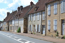 Houses on the main road in Champlemy | |
show Location of Champlemy | |
 Champlemy | |
| Coordinates: 47°17′12″N 3°21′07″E / 47.2867°N 3.3519°ECoordinates: 47°17′12″N 3°21′07″E / 47.2867°N 3.3519°E | |
| Country | France |
| Region | Bourgogne-Franche-Comté |
| Department | Nièvre |
| Arrondissement | Cosne-Cours-sur-Loire |
| Canton | La Charité-sur-Loire |
| Government | |
| • Mayor (2020–2026) | René Faust |
| Area 1 | 36.82 km2 (14.22 sq mi) |
| Population (Jan. 2018)[1] | 328 |
| • Density | 8.9/km2 (23/sq mi) |
| Time zone | UTC+01:00 (CET) |
| • Summer (DST) | UTC+02:00 (CEST) |
| INSEE/Postal code | 58053 /58210 |
| Elevation | 240–381 m (787–1,250 ft) |
| 1 French Land Register data, which excludes lakes, ponds, glaciers > 1 km2 (0.386 sq mi or 247 acres) and river estuaries. | |


Champlemy (French pronunciation: [ʃɑ̃pləmi]) is a commune in the Nièvre department in central France.
Demographics[]
In 2017, the population was 332.
See also[]
References[]
- ^ "Populations légales 2018". INSEE. 28 December 2020.
| Wikimedia Commons has media related to Champlemy. |
This Nièvre geographical article is a stub. You can help Wikipedia by . |
Categories:
- Communes of Nièvre
- Nièvre geography stubs