Arrayou-Lahitte
Arrayou-Lahitte | |
|---|---|
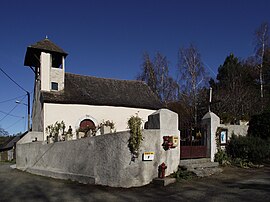 The church of Saint-Martin | |
show Location of Arrayou-Lahitte | |
 Arrayou-Lahitte | |
| Coordinates: 43°05′35″N 0°02′29″E / 43.0931°N 0.0414°ECoordinates: 43°05′35″N 0°02′29″E / 43.0931°N 0.0414°E | |
| Country | France |
| Region | Occitanie |
| Department | Hautes-Pyrénées |
| Arrondissement | Argelès-Gazost |
| Canton | Lourdes-2 |
| Intercommunality | CA Tarbes-Lourdes-Pyrénées |
| Government | |
| • Mayor (2020–2026) | Valérie Lanne[1] |
| Area 1 | 4.81 km2 (1.86 sq mi) |
| Population (Jan. 2018)[2] | 105 |
| • Density | 22/km2 (57/sq mi) |
| Time zone | UTC+01:00 (CET) |
| • Summer (DST) | UTC+02:00 (CEST) |
| INSEE/Postal code | 65247 /65100 |
| Elevation | 393–699 m (1,289–2,293 ft) (avg. 396 m or 1,299 ft) |
| 1 French Land Register data, which excludes lakes, ponds, glaciers > 1 km2 (0.386 sq mi or 247 acres) and river estuaries. | |


Arrayou-Lahitte (French pronunciation: [aʁaju la.it]; Occitan: Arrajon era Hita) is a commune in the Hautes-Pyrénées department in southwestern France.
Population[]
| Year | Pop. | ±% |
|---|---|---|
| 1962 | 83 | — |
| 1968 | 98 | +18.1% |
| 1975 | 84 | −14.3% |
| 1982 | 87 | +3.6% |
| 1990 | 83 | −4.6% |
| 1999 | 93 | +12.0% |
| 2007 | 105 | +12.9% |
| 2009 | 101 | −3.8% |
| 2015 | 110 | +8.9% |
See also[]
References[]
- ^ "Répertoire national des élus: les maires". data.gouv.fr, Plateforme ouverte des données publiques françaises (in French). 2 December 2020.
- ^ "Populations légales 2018". INSEE. 28 December 2020.
| Wikimedia Commons has media related to Arrayou-Lahitte. |
This Hautes-Pyrénées geographical article is a stub. You can help Wikipedia by . |
Categories:
- Communes of Hautes-Pyrénées
- Hautes-Pyrénées geography stubs