Bangarmau
Bangarmau
Bangermau | |
|---|---|
Nagar palika parishad | |
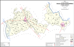 Map of Bangarmau CD block | |
 Bangarmau Location in Uttar Pradesh, India | |
| Coordinates: 26°54′N 80°13′E / 26.9°N 80.22°ECoordinates: 26°54′N 80°13′E / 26.9°N 80.22°E | |
| Country | |
| State | Uttar Pradesh |
| District | Unnao |
| Area | |
| • Total | 3.5 km2 (1.4 sq mi) |
| Elevation | 122 m (400 ft) |
| Population (2011)[1] | |
| • Total | 44,204 |
| • Density | 13,000/km2 (33,000/sq mi) |
| Languages | |
| • Official | Hindi |
| • Spoken | Awadhi English |
| Time zone | UTC+5:30 (IST) |
| Vehicle registration | UP-35 |

Bangarmau is a big city with Tehsil Bangarmau (earlier in Safipur), in the Unnao district, Uttar Pradesh, India.[1] It is located on high ground overlooking the left bank of the ,[2] about 50 km northwest of Unnao and 22 km northwest of Safipur.[1] Roads fan out in all directions from Bangarmau, including the main Unnao-Hardoi road that passes through town.[2] Major commodities produced here include wheat flour, rice, and pulses.[1] As of 2011, the population of Bangarmau is 44,204, in 7,600 households.[1]
Bangarmau is a central point for local agricultural trade that serves as the main market for the nearby villages. It is connected to Delhi via the Agra Lucknow Expressway (475 km), Lucknow (65 km), Kanpur (70 km) (connected with the rail line from Balamau to Kanpur), Unnao (50 km), Hardoi (65 km) and Bareilly (197 km) by highways.
Bangarmau is a pilgrim center. A Tantrik temple, Raj Rajeshwari Mandir, was established in the early nineteenth century. An old temple named Baba Bodheswar is also situated west of the town. Near Bangarmau is Sanchan Kot, where in 2009, a Archaeological Survey of India excavation unearthed a 2000-year-old Shiva temple.[3]
Bangarmau has the largest market with bill sales in Unnao District. Early in 1920s there were the main families of Bangarmau: the Katiyar, kurmi, Chowdhurys, and the Baniyas and Dhobis.[citation needed]
History[]
Bangarmau was the first Muslim settlement in the area of present-day Unnao district, dating back to around the year 1300.[2] According to legend, the town was founded when a Muslim holy man named Sayyid Ala-ud-Din attempted to take up residence near the town of , which was ruled by a Hindu raja named Nal.[2] The raja refused and sent men to expel him by force, but Ala-ud-Din laid a curse on them so that the raja and all his people died, and the town of Nawal was turned upside-down.[2] The modern village of Nawal is built on top of its ruins, and old artifacts are still sometimes dug up.[2]
Sayyid Ala-ud-Din then went on to found the city of Bangarmau, which is where he was buried after he died.[2] A shrine was built over his grave, and it has an inscription dated to 702 AH, or 1302 CE.[2] Ala-ud-Din's descendants remain custodians of the shrine, which at one point was "rich and famous" before declining by the turn of the 20th century.[2]
Despite Bangarmau's Muslim origin and prominent shrine, though, it never became thoroughly Islamised, and the population remains mostly Hindu.[2]
Bangarmau is referred to in the Baburnama, the autobiography of Babur, where Babur mentions that he camped near a lake situated in Bangarmau on 15 March 1528 and the following day left for Lucknow. Bangarmau belongs to the area under influence of a Sufi saint Madar Shah of the Madaria sect. Several villages named are after him situated around Bangarmau.
Bangarmau's population steadily declined during the second half of the 19th century.[2]
At the turn of the 20th century, Bangarmau was described as a well-built town almost surrounded by extensive orchards; about half the houses were built with brick.[2] It had 16 mosques and several Hindu temples, as well as a police station and a middle school with 120 students.[2] The town held markets twice weekly, on Wednesdays and Sundays; its commerce was helped by its advantageous location at a crossroads.[2]
Demographics[]
| Year | Pop. | ±% |
|---|---|---|
| 1901 | 6,051 | — |
| 1911 | 5,783 | −4.4% |
| 1921 | 4,919 | −14.9% |
| 1931 | 5,090 | +3.5% |
| 1941 | 5,921 | +16.3% |
| 1951 | 5,483 | −7.4% |
| 1961 | Not given | — |
| 1971 | Not given | — |
| 1981 | 14,958 | — |
| 1991 | 20,023 | +33.9% |
| 2001 | 31,871 | +59.2% |
| 2011 | 44,204 | +38.7% |
| Source: 2011 Census of India[1] | ||
According to the 2011 census, Bangarmau has a population of 10,957 people, of which 22,985 are male and 21,219 are female.[1] Males constitute 52% of the population and females 48%.[4] The population of children between the ages of 0-6 is 5,649, which is 12.78% of the total population.[4] The sex ratio of this group is 941 females to every 1000 males, which is higher than the urban average for Unnao district.[1] Members of Scheduled Castes make up 9.48% of Bangarmau's population, while no members of scheduled tribes were recorded.[1] The town's literacy rate was 68.4% (counting only people age 7 and up); literacy was higher among men and boys (73.2%) than among women and girls (63.0%).[1]
In terms of employment, 22.5% of Bangarmau residents were classified as main workers (i.e. people employed for at least 6 months per year) in 2011.[1] Marginal workers (i.e. people employed for less than 6 months per year) made up 7.9%, and the remaining 69.6% were non-workers.[1] Employment status varied substantially according to gender, with 47.8% of men being either main or marginal workers, compared to only 11.5% of women.[1] -->
Famous places[]
Most important place is Rajrajeshwari Temple near bank of river Kalyani in the south of the town.Other important place is Bodheswar Mahadev Temple. The prehistoric stone tools of great archaeological importance have been found in Bangarmau town. Bangarmau is trade centre of Agriculture commodities.Sandi bird sanctuary is about 25 km from the town.Holy river Ganga and its ghat(river Bank )is about 15 km from the town.
Education[]
Schools and colleges:
- Indira Gandhi Rajkeeya Degree College
- Subhash Inter College
- Rani Vidya Mandir School Bangarmau Unnao
- Maya International School, Near Tehsil
- Pratima Inter College Bangarmau Unnao
- R.S. Inter College
- Shri Ram Public School for kids
- R.R.D.S Inter College New Katra
- Shri Durgeshvar Vidya Mandir
- Madrasa Ahle Sunnat Gousul Uloom Mukariyana
- K.D.S. Public School Bhatpuri
- New. National Public School Purviya tola Bangarmau
- B.D.S.R. Inter College Radheshyam Nagar Kanpur Hardoi Bypass near Power House Bangarmau
- P.J.P Higher Secondary School (kasba tola Bangarmau Unnao)
- Indira Gandhi Government PG College
- Gautam Buddha Mahavidyalay (College), Ismailpur, Ambapara, Bangarmau
Villages[]
Bangarmau CD block has the following 82 villages:[1]
| Village name | Total land area (hectares) | Population (in 2011) |
|---|---|---|
| 499.5 | 1,048 | |
| 205.4 | 2,214 | |
| 104.6 | 880 | |
| 78.7 | 1,199 | |
| 287.4 | 2,144 | |
| 304.8 | 0 | |
| 19.8 | 0 | |
| 21.6 | 0 | |
| 841 | 1,936 | |
| 627 | 1,588 | |
| 148.8 | 0 | |
| 105.6 | 770 | |
| 350.6 | 3,081 | |
| 145.3 | 888 | |
| 413 | 1,542 | |
| 133.8 | 531 | |
| 180.3 | 1,222 | |
| 159.7 | 972 | |
| 150.7 | 1,194 | |
| 251 | 1,567 | |
| 95.5 | 991 | |
| 296.1 | 2,215 | |
| 122.5 | 599 | |
| 223 | 1,568 | |
| 357.6 | 4,582 | |
| 483 | 3,133 | |
| 348.3 | 2,051 | |
| 341.9 | 1,340 | |
| 243.1 | 2,230 | |
| 268 | 1,382 | |
| 210.2 | 1,213 | |
| 394.3 | 2,389 | |
| 229.4 | 1,371 | |
| 535.7 | 2,458 | |
| 656.8 | 1,239 | |
| 81.4 | 564 | |
| 309 | 4,870 | |
| 155.3 | 254 | |
| 164 | 404 | |
| 88.6 | 0 | |
| 238.6 | 2,492 | |
| 438.7 | 1,690 | |
| 229.2 | 1,372 | |
| 407.3 | 3,219 | |
| 213.9 | 1,981 | |
| 250.7 | 1,556 | |
| 461.8 | 2,684 | |
| 225.2 | 1,619 | |
| 65.7 | 1,166 | |
| 51.7 | 733 | |
| Surseni | 305.8 | 4,597 |
| 134.8 | 1,785 | |
| 150.8 | 813 | |
| 111.4 | 745 | |
| 176.3 | 2,156 | |
| 298.4 | 2,675 | |
| 43.3 | 297 | |
| 311.6 | 998 | |
| 90 | 2,302 | |
| 334.5 | 1,866 | |
| 644.4 | 2,477 | |
| 347.2 | 3,537 | |
| 391.4 | 4,769 | |
| 543.5 | 1,657 | |
| 399.4 | 1,814 | |
| 236.4 | 982 | |
| 203.8 | 805 | |
| 605.5 | 3,816 | |
| 281.5 | 1,798 | |
| 217.2 | 1,119 | |
| 1,069.3 | 7,390 | |
| 359.5 | 3,835 | |
| 220.7 | 1,159 | |
| 1,152.9 | 6,902 | |
| 481.2 | 2,935 | |
| 113.4 | 502 | |
| 106.6 | 646 | |
| 152.3 | 943 | |
| 242.4 | 1,601 | |
| 239.1 | 1,368 | |
| 172.2 | 1,235 | |
| 1,914.5 | 13,484 |
References[]
- ^ a b c d e f g h i j k l m n o "Census of India 2011: Uttar Pradesh District Census Handbook - Unnao, Part A (Village and Town Directory)". Census 2011 India. pp. 36–55, 93–109, 525–39. Retrieved 28 June 2021.
- ^ a b c d e f g h i j k l m n Nevill, H.R. (1903). Unao: A Gazetteer, Being Volume XXXVIII Of The District Gazetteers Of The United Provinces Of Agra And Oudh. Allahabad: Government Press. pp. 156–60. Retrieved 28 June 2021.
- ^ Sharda, Shailvee (23 February 2009). "2000-yr-old Shiva shrine found". The Times of India. Retrieved 16 December 2019.
- ^ a b "Bangarmau Town Population - Unnao, Uttar Pradesh". Censusindia2011.com. Retrieved 16 December 2019.
- Cities and towns in Unnao district